Nouvelle-Zélande - New Zealand
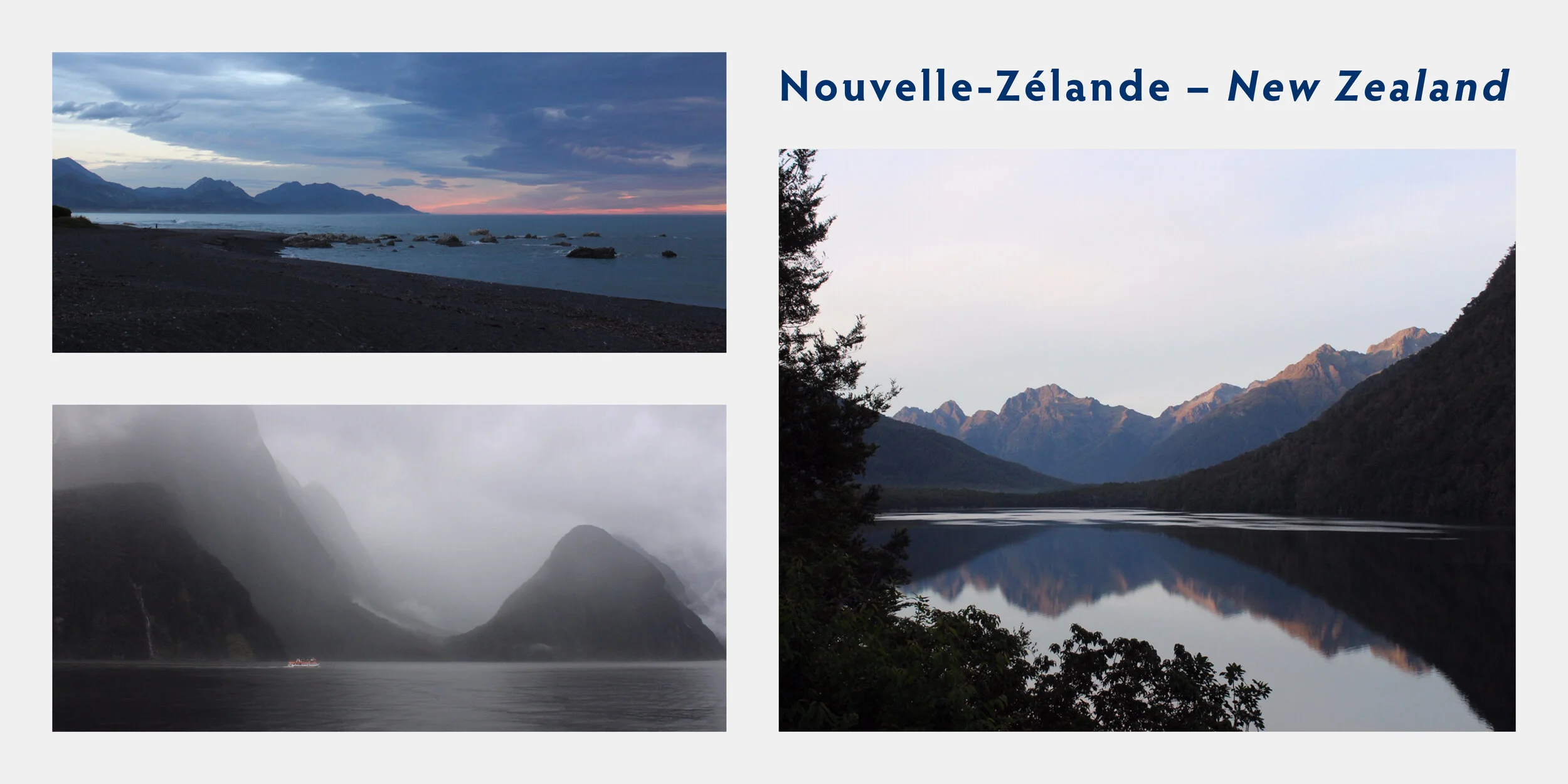
La Nouvelle-Zélande est un pays d’Océanie située au sud-ouest de l’Océan Pacifique Sud. Elle est constituée de deux îles principales (l’île du nord et l’île du sud) et environ 600 autres petites îles.
La Nouvelle-Zélande est très isolée géographiquement ce qui a permis le développement d’une flore et d’une faune endémique très riche et variée.
L’histoire de ce pays est la plus courte de tous les pays du monde, car il s’agit d’un des derniers territoires découverts par l’homme. Les premiers colons étaient des Polynésiens qui arrivaient en Nouvelle Zélande vers 1200 après J-C et qui ont établis la culture maorie.
New Zealand is a country in Oceania, situated south-west of the South Pacific Ocean. It consists of two main islands (the northern island and the southern island) as well as approximately 600 other small islands.
New Zealand is geographically isolated which led to the evolution of an endemic flora and fauna that is very rich and diverse.
The history of this country is one of the shortest of all the countries in the world due to New Zealand being one of the last territories discovered by man. The first settlers were Polynesians that arrived in 1200 AD and who established the Maori people.
Christchurch
Durant mon passage à Melbourne, qui était ma dernière destination en l’Australie j’ai décidé de m’organiser une visite sur l’île du Sud en Nouvelle-Zélande. J’ai réservé un camping car et un billet d’avion avec la compagnie aérienne JetStar, direction Christchurch.
À mon arrivée, j’ai eu plusieurs surprises. Malgré le fait que la Nouvelle-Zélande soit très près de l’Australie, il y a une différence de température d’environ 20˚C. Le volant de mon véhicule était à droite… On conduit à gauche dans ce pays!
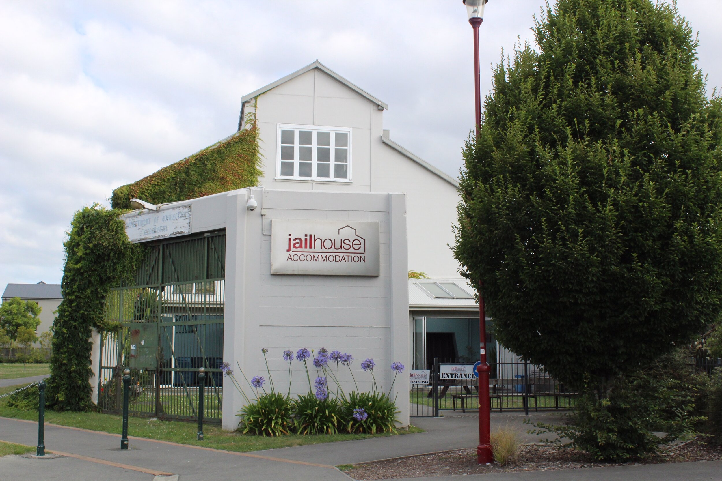
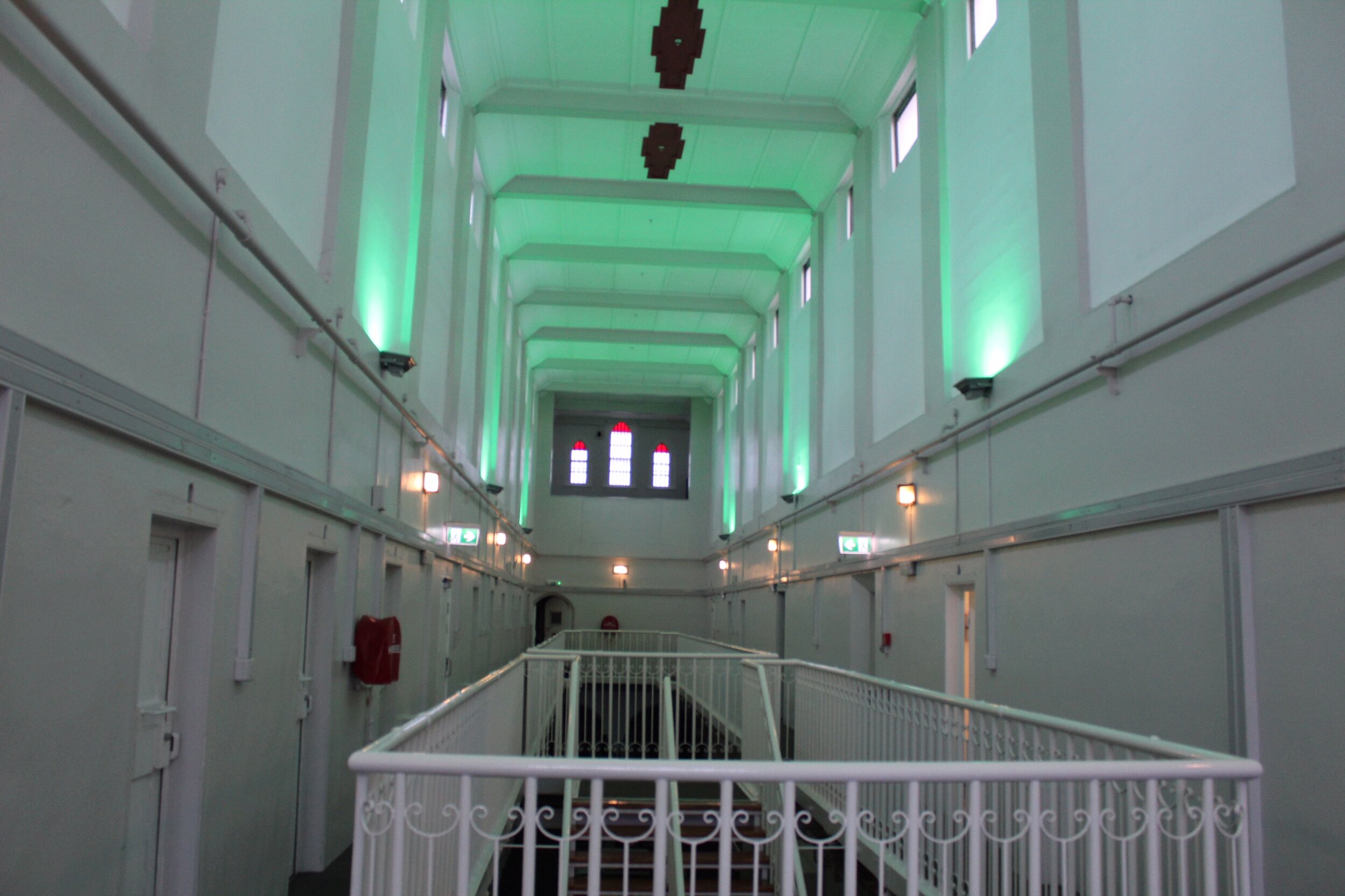
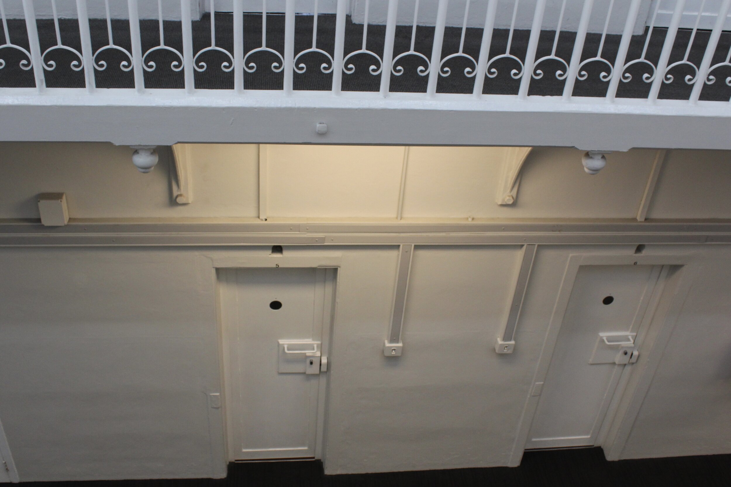
Malgré le fait que j’avais réservé un camping car, j’ai décidé de passer ma première nuit dans une ancienne prison transformée en auberge de jeunesse, le Jailhouse Accommodation. Je me suis également arrêté faire pour faire l’épicerie et obtenir des conseils pour mon itinéraire autour de l’île.
À consulter : CamperMate.co.nz
When I was in Melbourne, my last destination in Australia, I decided to plan a trip to New Zeland’s South Island. I rented a van and bought a plane ticket with JetStar. Destination : Christchurch!
When I arrived, I had a few surprises. Despite the fact that New Zealand is very close to Australia, there’s a temperature difference of about 20˚C. Also the steering wheel of my van was on the right… They drive on the left in this country!
Even if I had a van, I decided to spend the night in an old prison converted into a hostel, the Jailhouse Accommodation. I’ve also stopped for groceries and to get tips on my route around the island.
To consult : Campermate.co.nz

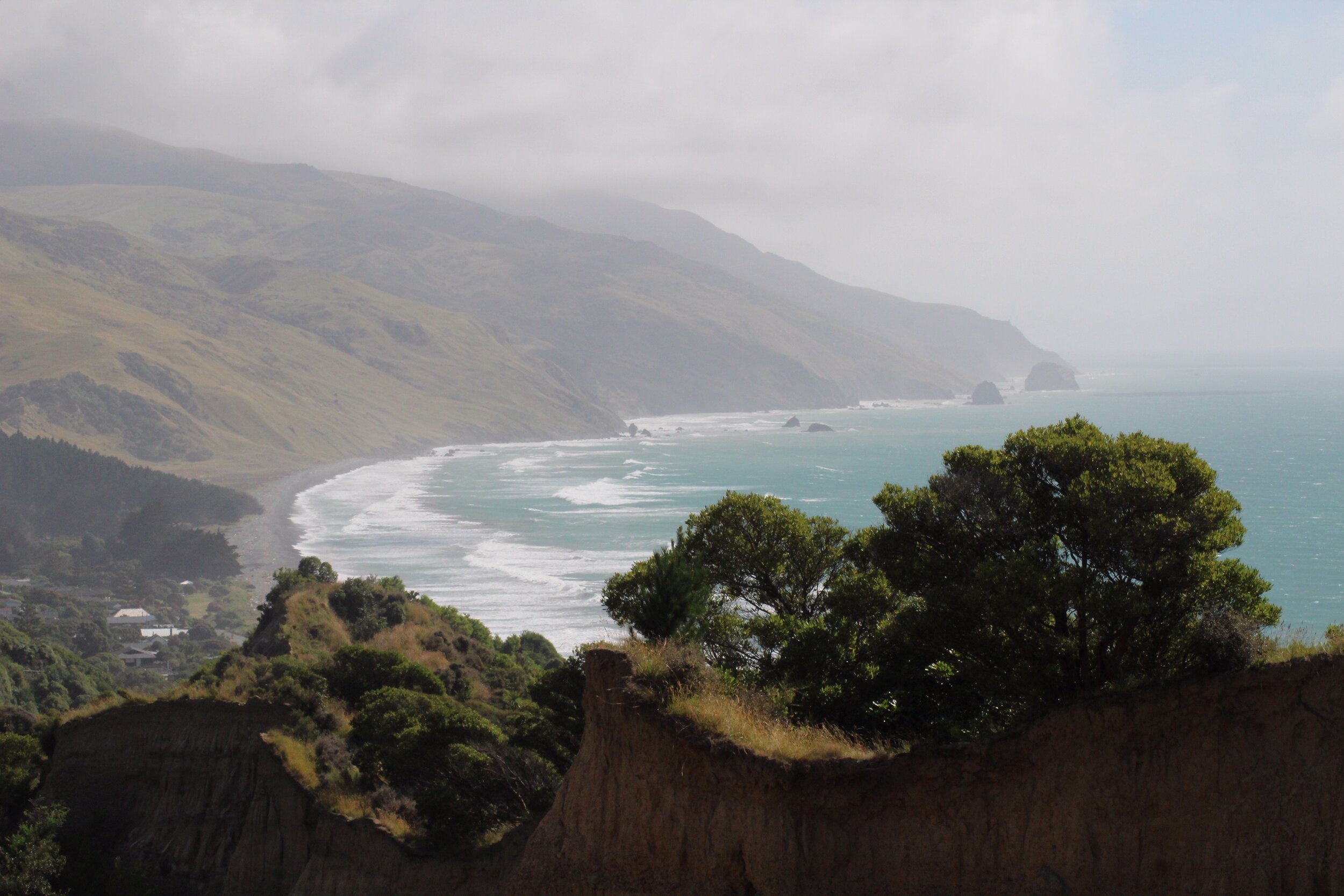
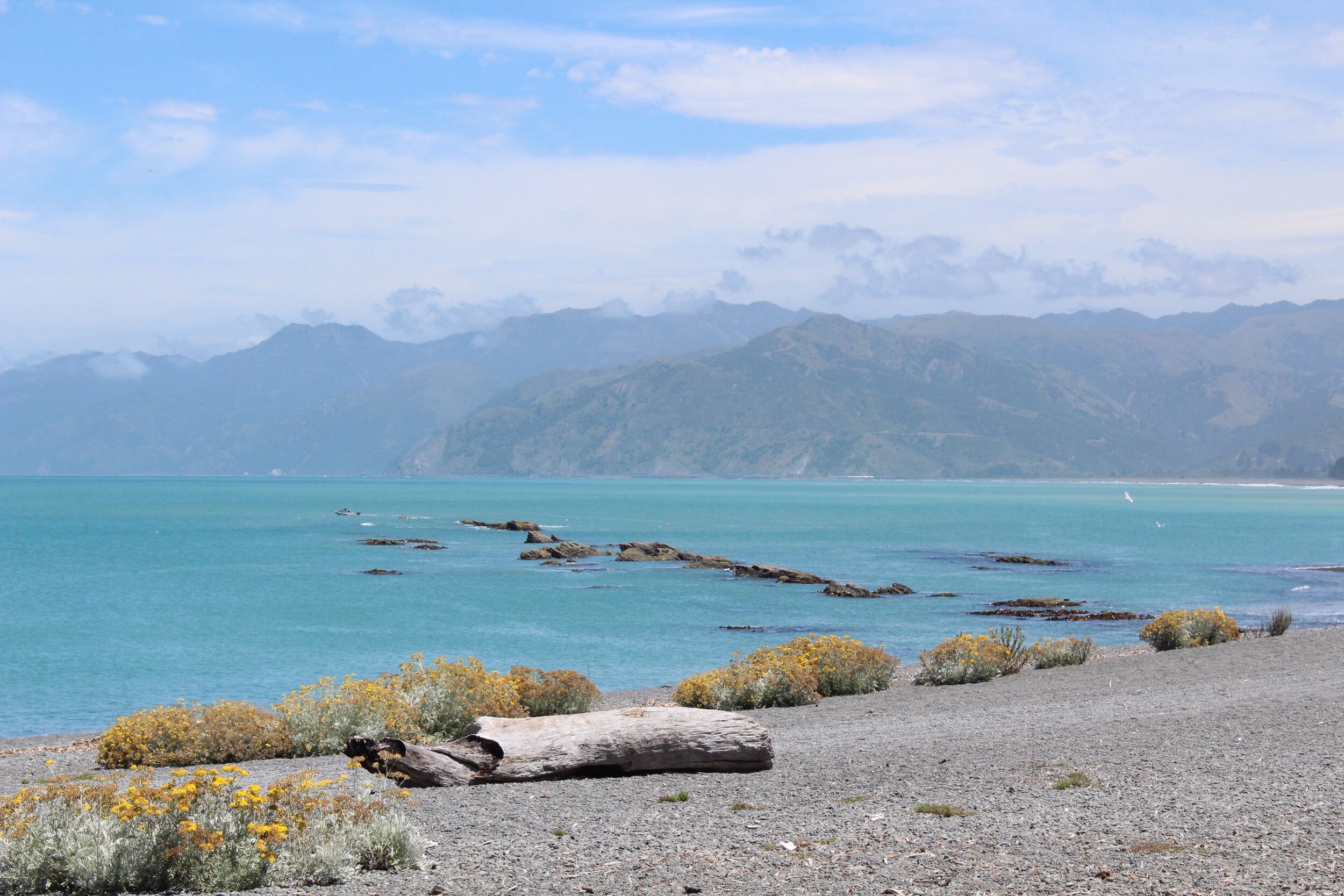
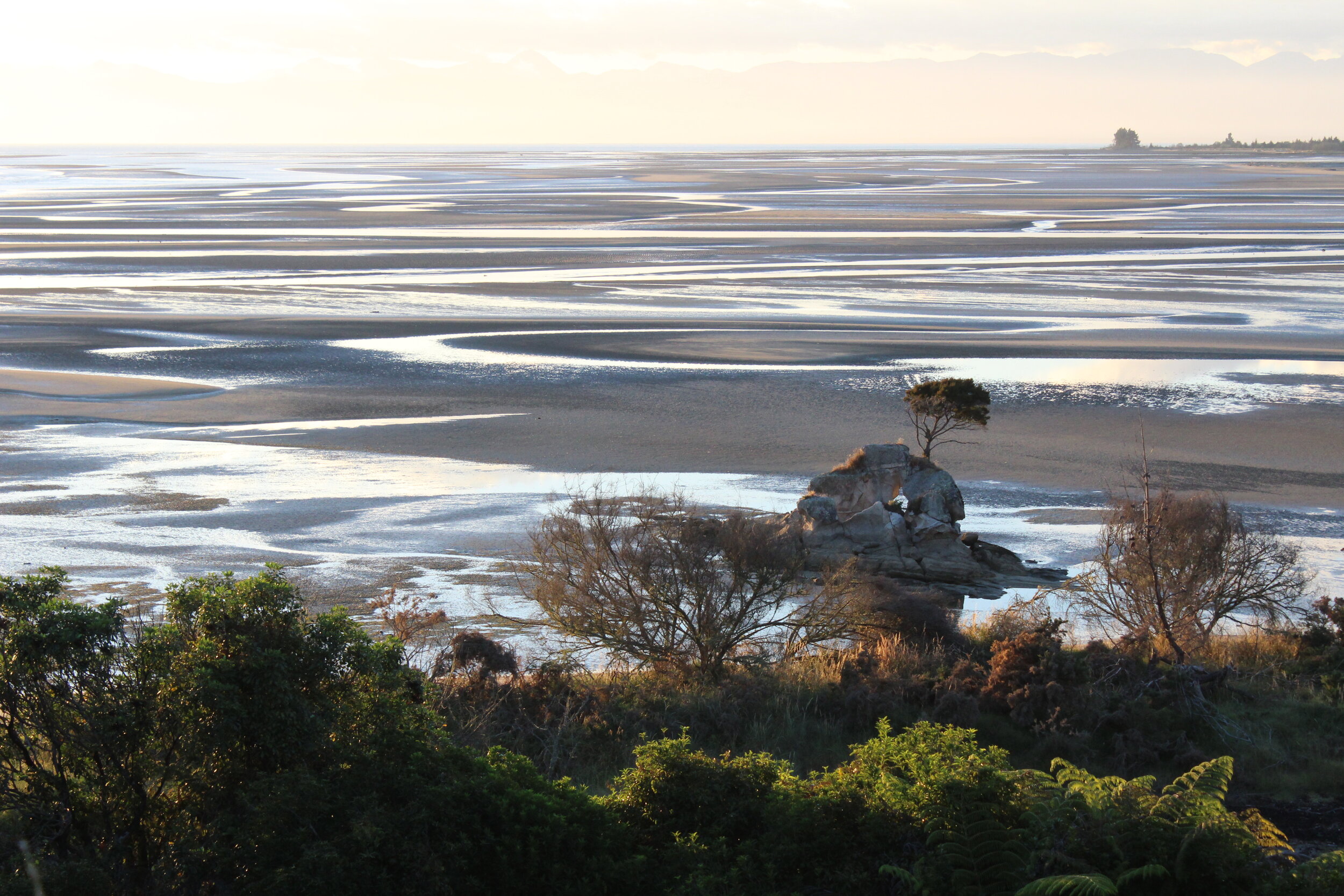
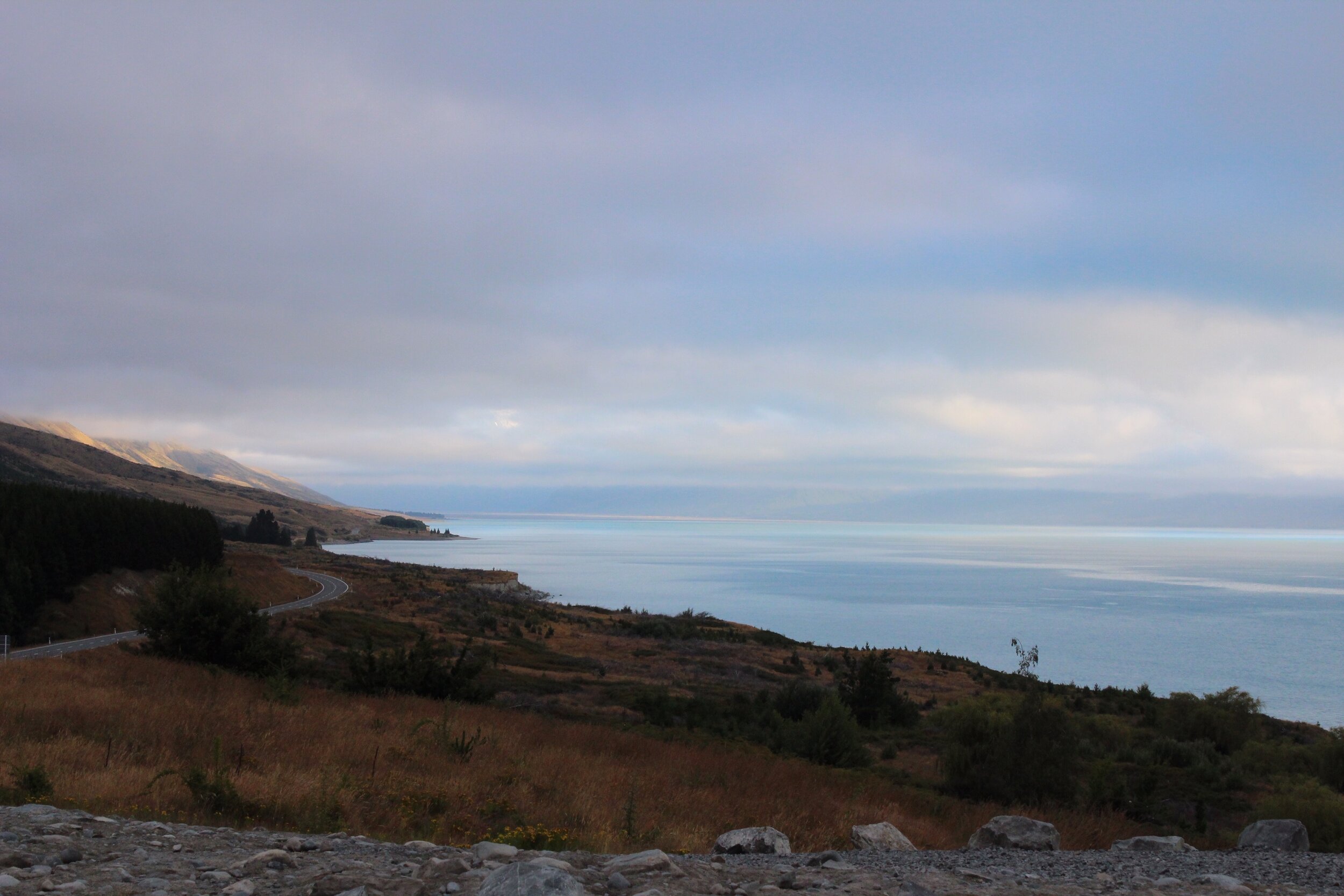
Gore Bay et Kaikoura
Après ma nuit à Christchurch, j’étais enfin prêt à débuter mon aventure. Direction Gore Bay, à 115 km de là.
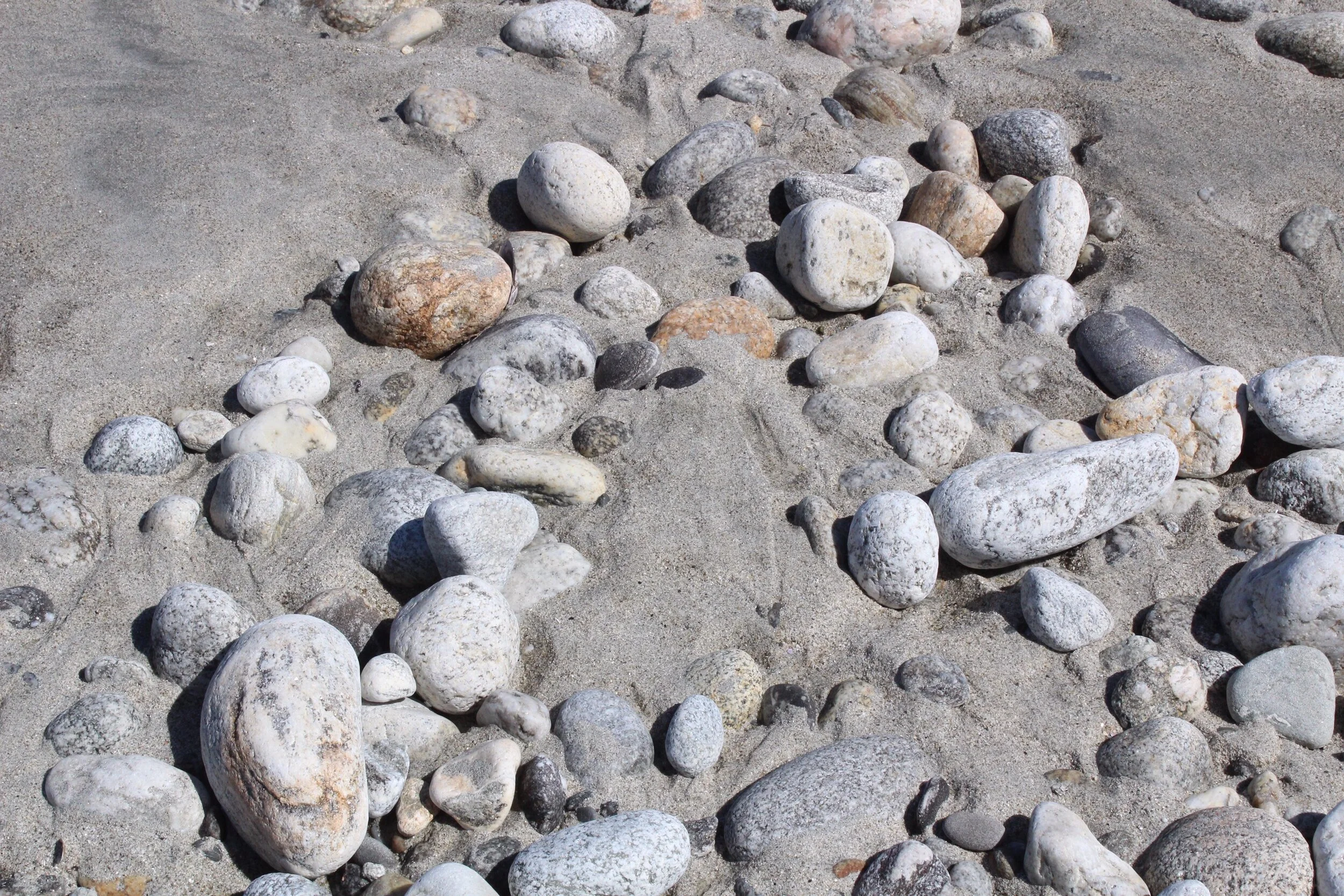
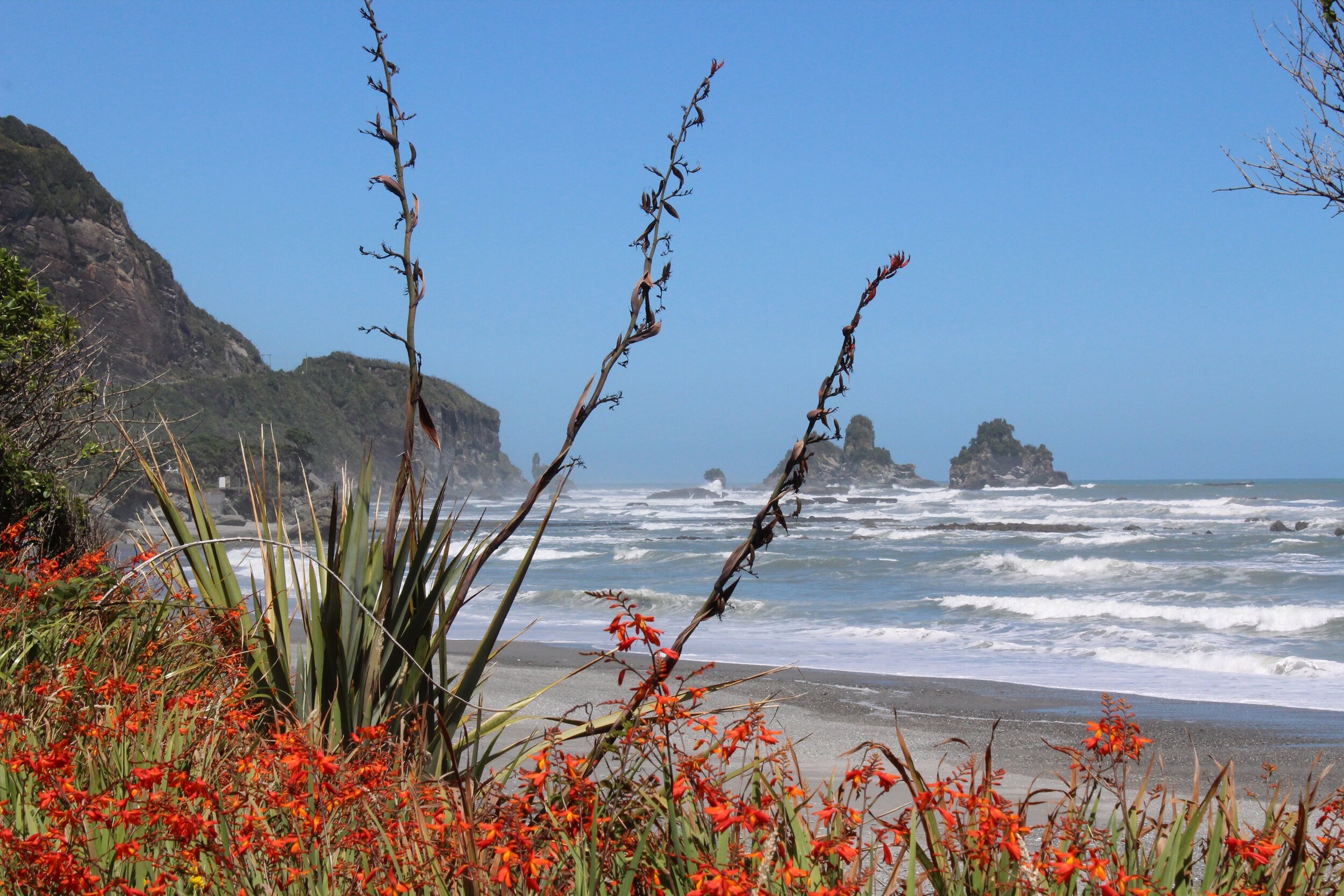
Gore Bay se situe au Nord-Est de l’île, côté océan Pacifique. On y trouve des maisons de plage d’été, deux campings et une plage de surf. J’ai dormi aux campings Gore Bay et Boxton Camp Grounds.
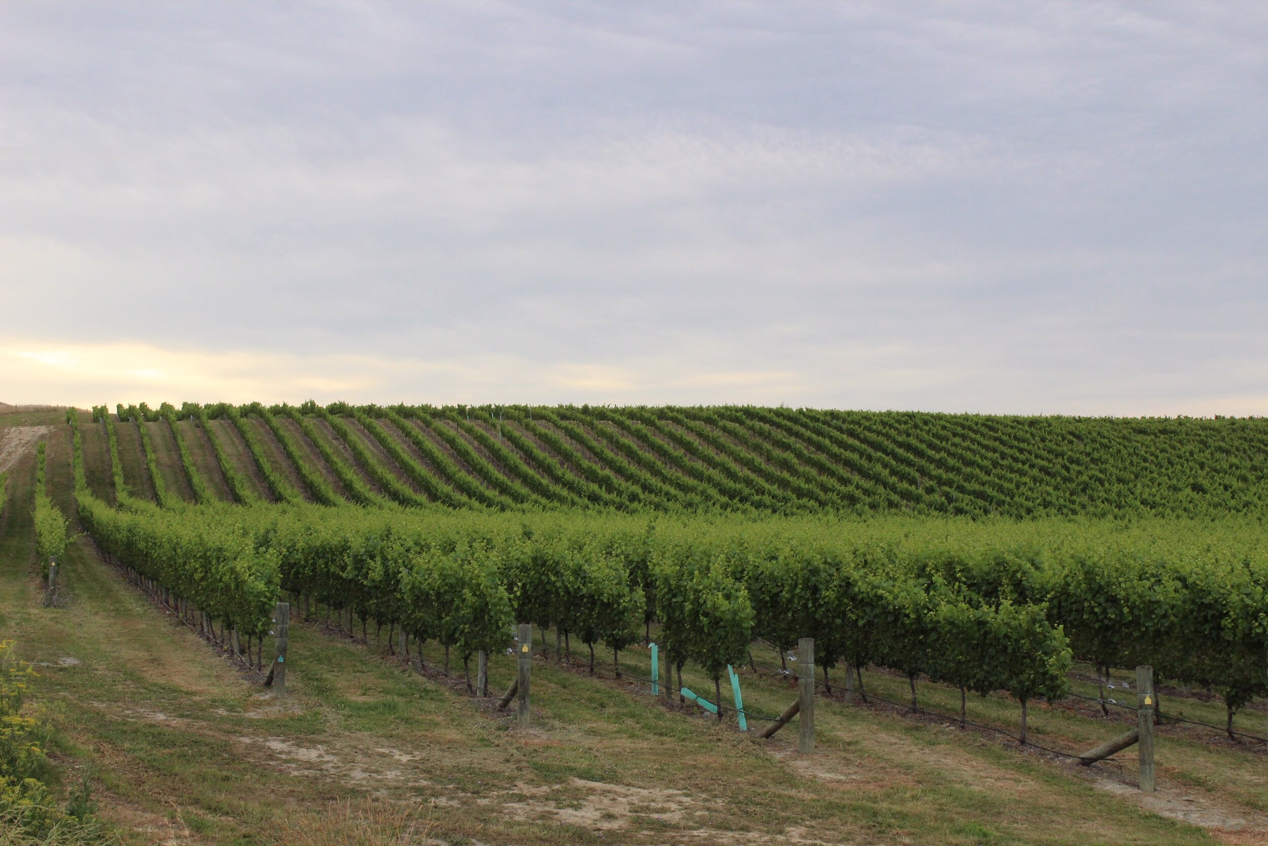
Ma deuxième destination était Kaikoura, à 131 km de Gore Bay. On peut y voir des phoques, des baleines et des dauphins! Le repas populaire ici est à base de langoustes. J’ai dormi au camping Kaikoura Peketa Beach Holiday Park.
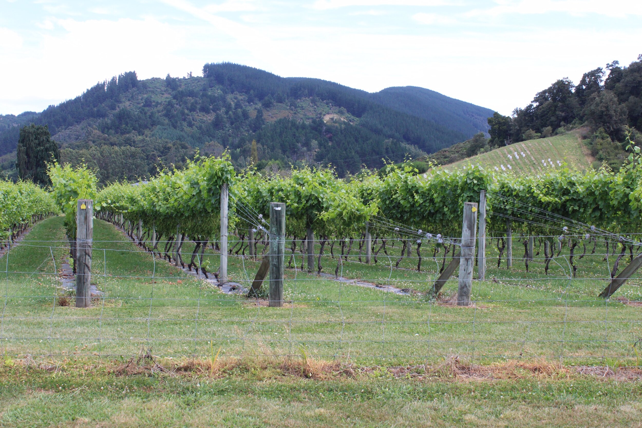
Vignobles à voir dans la région :
Pegasus Bay Winery
Yealands Estate
After my night in Christchurch, I was finally ready to start my adventure. Direction : Gore Bay, 115 km away.
Gore Bay is located in the northeast of the island, on the Pacific Ocean side. There are summer beach houses, two campgrounds and a surf beach. I slept at Gore Bay and Boxton Camp Grounds campsites.
My second destination was Kaikoura, 131 km from Gore Bay. There you can watch seals, whales and dolphins! The local meal here is made of lobsters. I slept at Kaikoura Peketa Beach Holiday Park.
Some vineyards to see in the region:
Pegasus Bay Winery
Yealands Estate

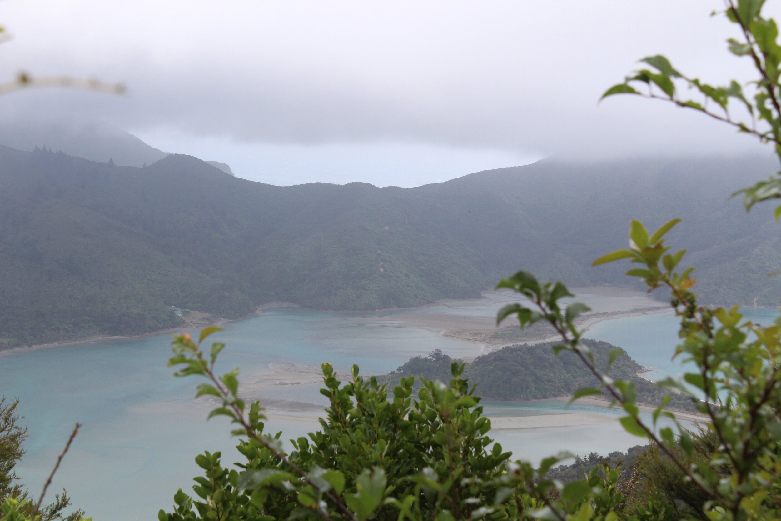
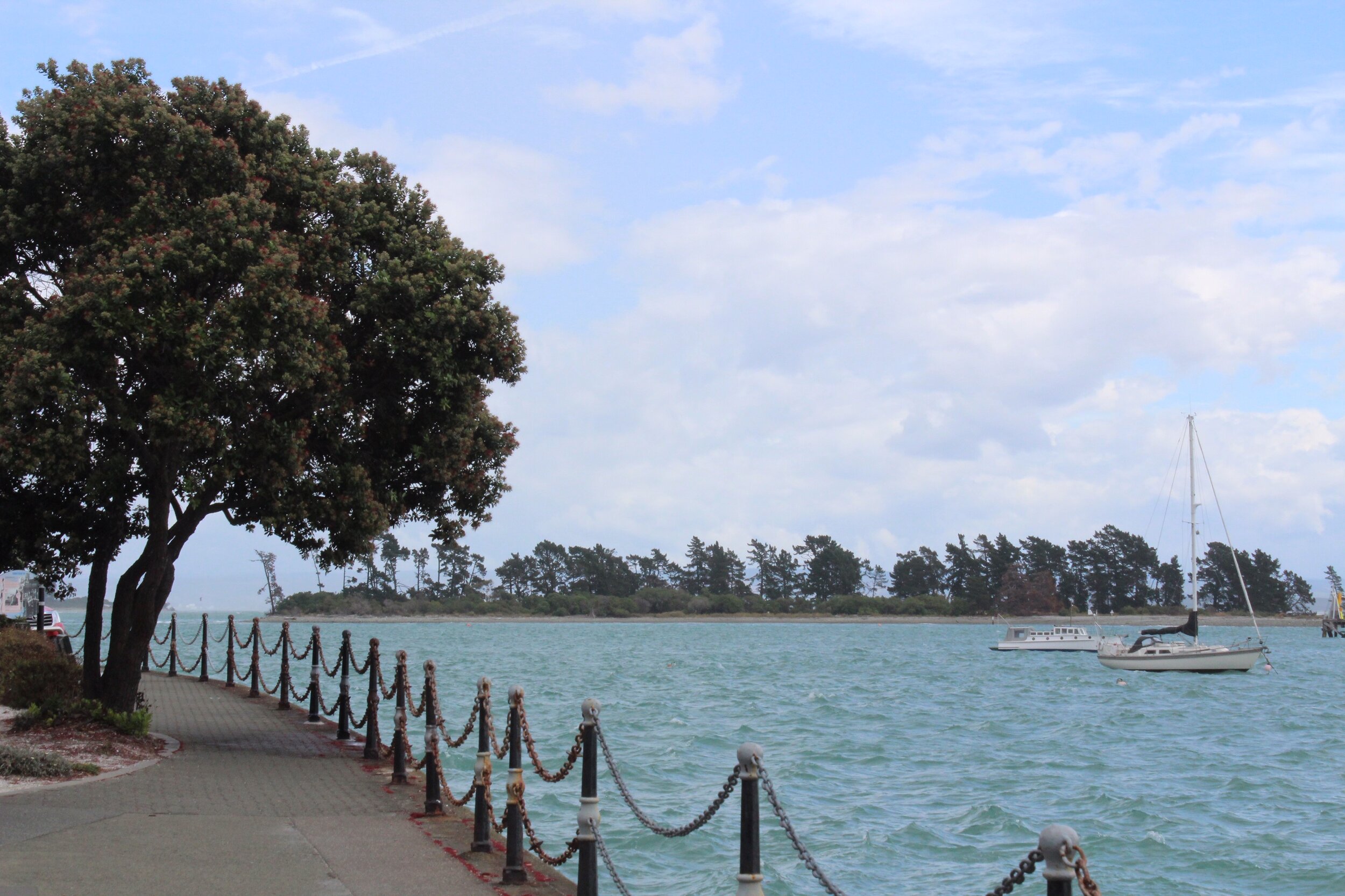
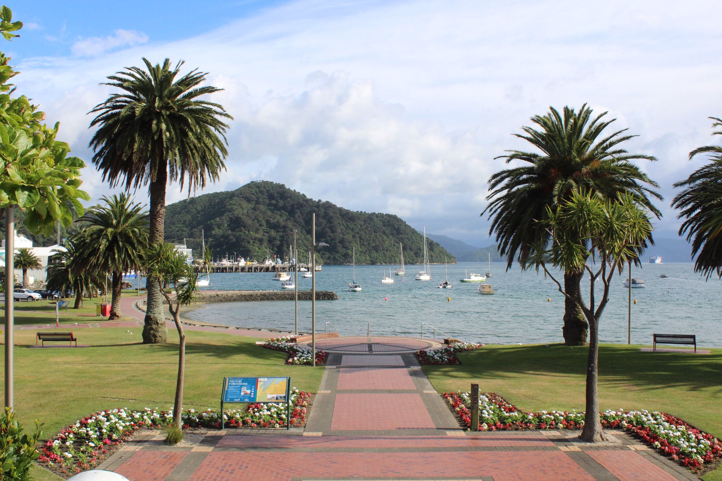
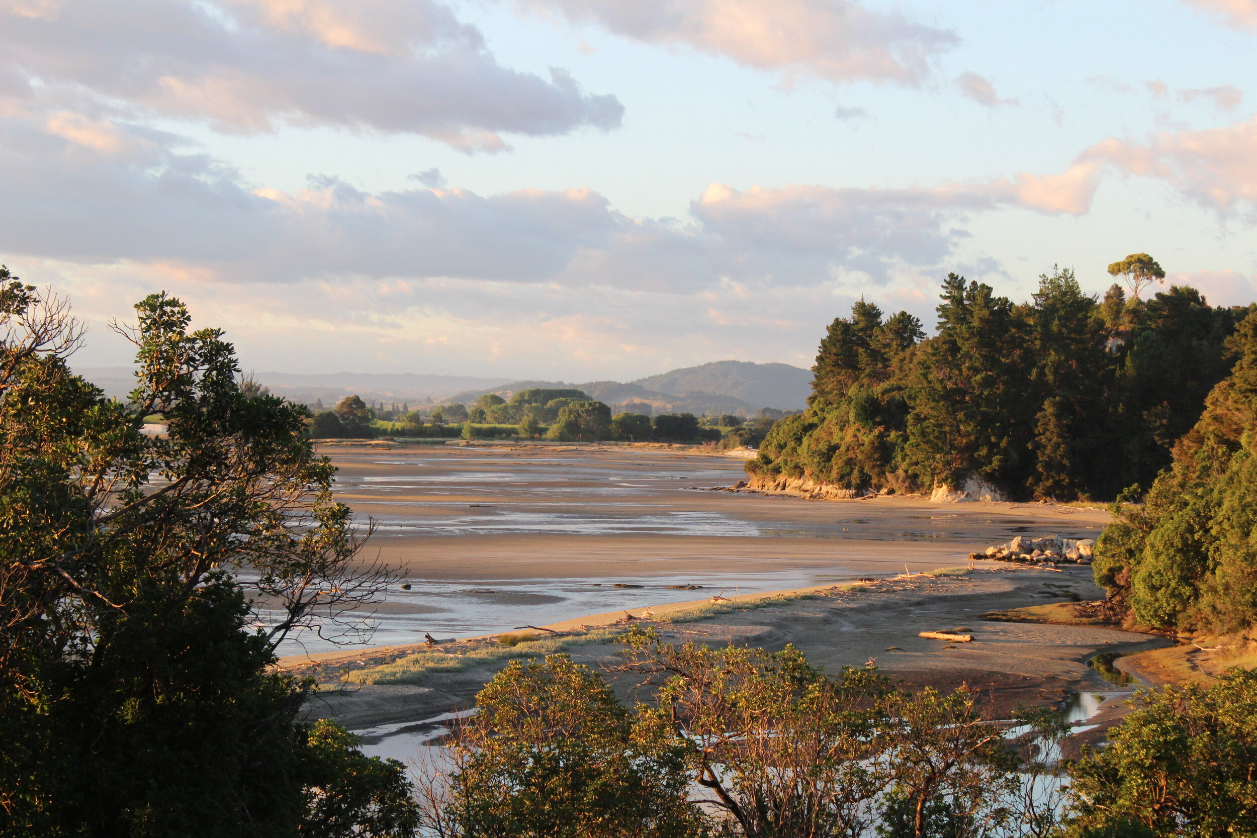
Picton, Okiwi Bay et Nelson
Je suis ensuite parti vers Picton, à 156 km de Kaikoura.
Picton est une importante plateforme maritime, puisqu’elle relie l’île du Sud et l’île du Nord par le détroit de Cook. C’est une belle petite ville, avec sa marina et ses voiliers.
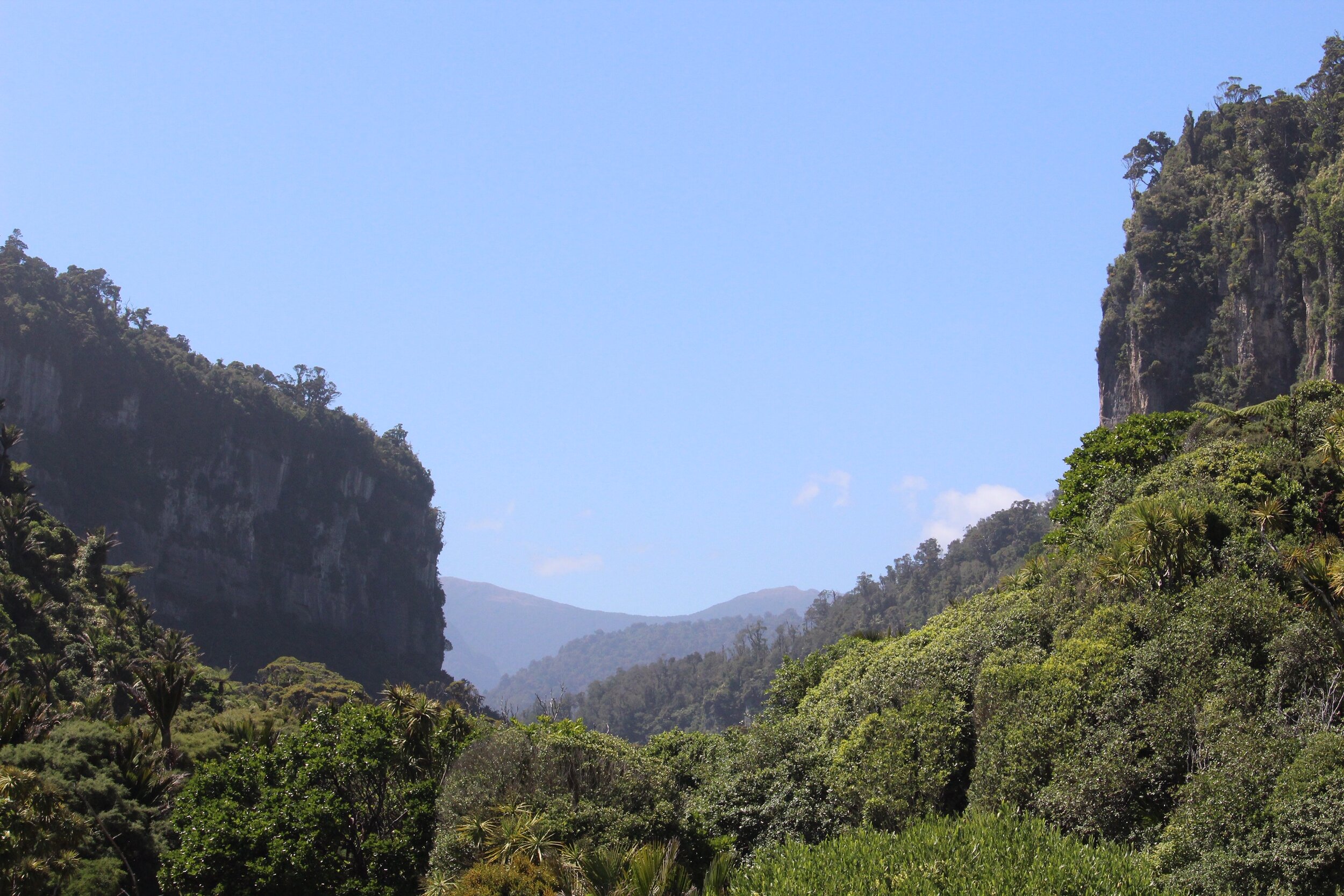
Après ma pause détente à Picton, j’étais en route pour Kiwi Bay, à 111 km de là. Lors de mon passage, il y avait beaucoup de brouillard. J’ai tout de même eu la chance de visiter un peu et de prendre quelques photos. C’est un endroit réputé pour ses huitres et ses sentiers de randonnée pédestre.
Soixante-huit kilomètres plus loin, à l’est de la baie de Tasman, Nelson était ma dernière destination avant un arrêt pour la nuit. Le peuple Maori a 700 ans d’histoire dans cette ville.
Je me suis stationné en face de la mer pour la nuit. J’ai plongé dans l’eau pour me rafraichir et j’ai relaxé sur la beach!
I then left for Picton, 156 km away from Kaikoura.
Picton is an important shipping platform, connecting the South and North Islands through the Cook Strait. It’s a beautiful little town with a marina and sailboats.
After my relaxing break in Picton, I was on my way to Kiwi Bay, 111 km away. During my visit, there was a lot of fog. I still had the chance to visit and take some pictures. It’s a place renowned for its oysters and hiking trails.
Sixty-eight kilometers east from Tasman Bay, Nelson was my last destination before an overnight stop. The Maori people have over 700 years of history in this city.
I parked in front of the sea for the night. I dived in the water to cool off and relaxed on the beach!

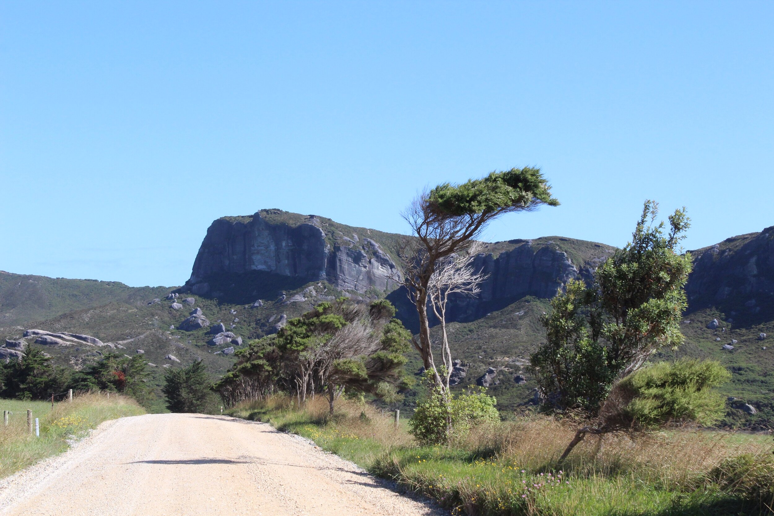
Parc national Abel Tasman
Abel Tasman National Park
Après ma nuit sur la plage à Nelson, j’étais en direction de Motueka, avec 47 km de route à faire. J’avais réservé à l’auberge de jeunesse Laughing Kiwi Backpackers, ayant besoin d’un lit et d’une bonne douche.
J’en ai profité pour aller visiter le centre d’information touristique de la ville pour mes prochaines aventures, dans le parc national Abel Tasman. Il y a plusieurs possibilités d’endroits où dormir dans ce parc, il n’est pas obligatoire d’utiliser un camping.
Le parc national Abel Tasman fait plus de 75 000 hectares et existe depuis 1942 et est situé au nord-est de l’ile du Sud. Durant ma visite, je me suis rendu jusqu’à Golden Bay!
Abel Tasman était un explorateur qui a été le premier européen à découvrir la Tasmanie et la Nouvelle-Zélande, en 1642.
After my night on Nelson beach, I was heading to Motueka, with 47 km of road to go. I booked at the Laughing Kiwi Backpackers hostel, in need of a bed and a good shower.
I took this opportunity to visit the city’s tourist information center for my next adventures in Abel Tasman National Park. There are several possibilities for places to sleep in this park, you don’t necessarily need an official campground.
The Abel Tasman National Park covers more than 75,000 hectares and has existed since 1942. It is located in the northeast of the South Island. During my visit, I went all the way to Golden Bay!
Abel Tasman was the first European explorer to discover Tasmania and New Zealand in 1642.
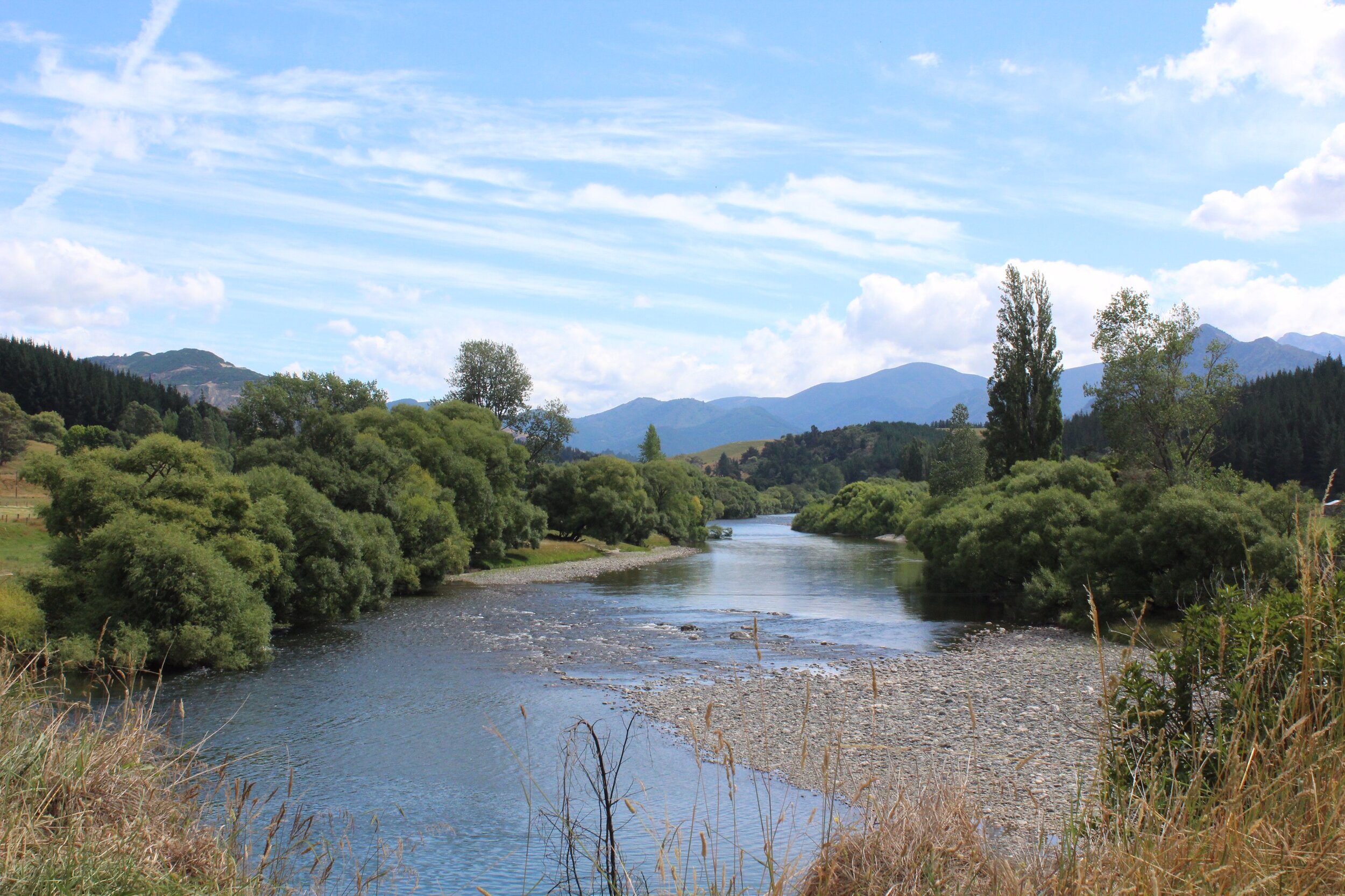
Mapua, lac Rotoiti et Westport
Mapua, Rotoiti and Westport
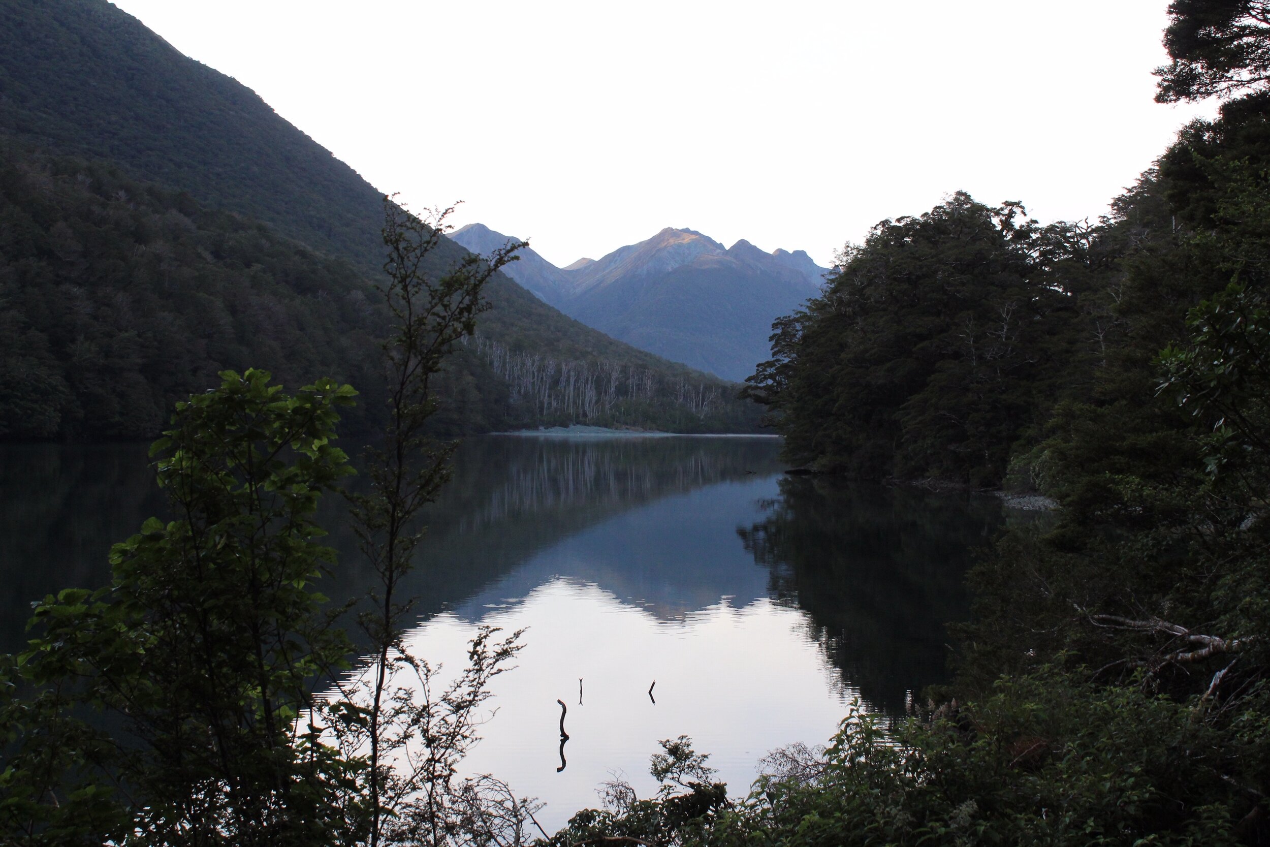
Après avoir passé plusieurs jours dans le Abel Tasman Parc, j’étais en direction de Mapua, dans la baie de Tasman. J’ai pris quelques photos et j’ai continué ma route vers Westport, où j’ai visité le lac Rotoiti!
Ce lac créé naturellement en 1967 lors de la fonte des glaces, est situé encore une fois dans la région de Tasman. Plusieurs pistes de randonnée entourent le lac.
Westport est à 221 km de Mapua, sur la côte ouest de l’île du Sud. Je m’y suis arrêté pour faire quelques achats et me détendre.
After several days in Abel Tasman Park, I headed towards Mapua, in Tasman Bay. I took some photos and continued on my way to Westport, where I visited Lake Rotoiti!
This lake, created naturally in 1967 when the ice melted, is once again located in the Tasman region. Several hiking trails surround the lake.
Westport is 221 km from Mapua, on the west coast of the South Island. I stopped there to do some shopping and relax.

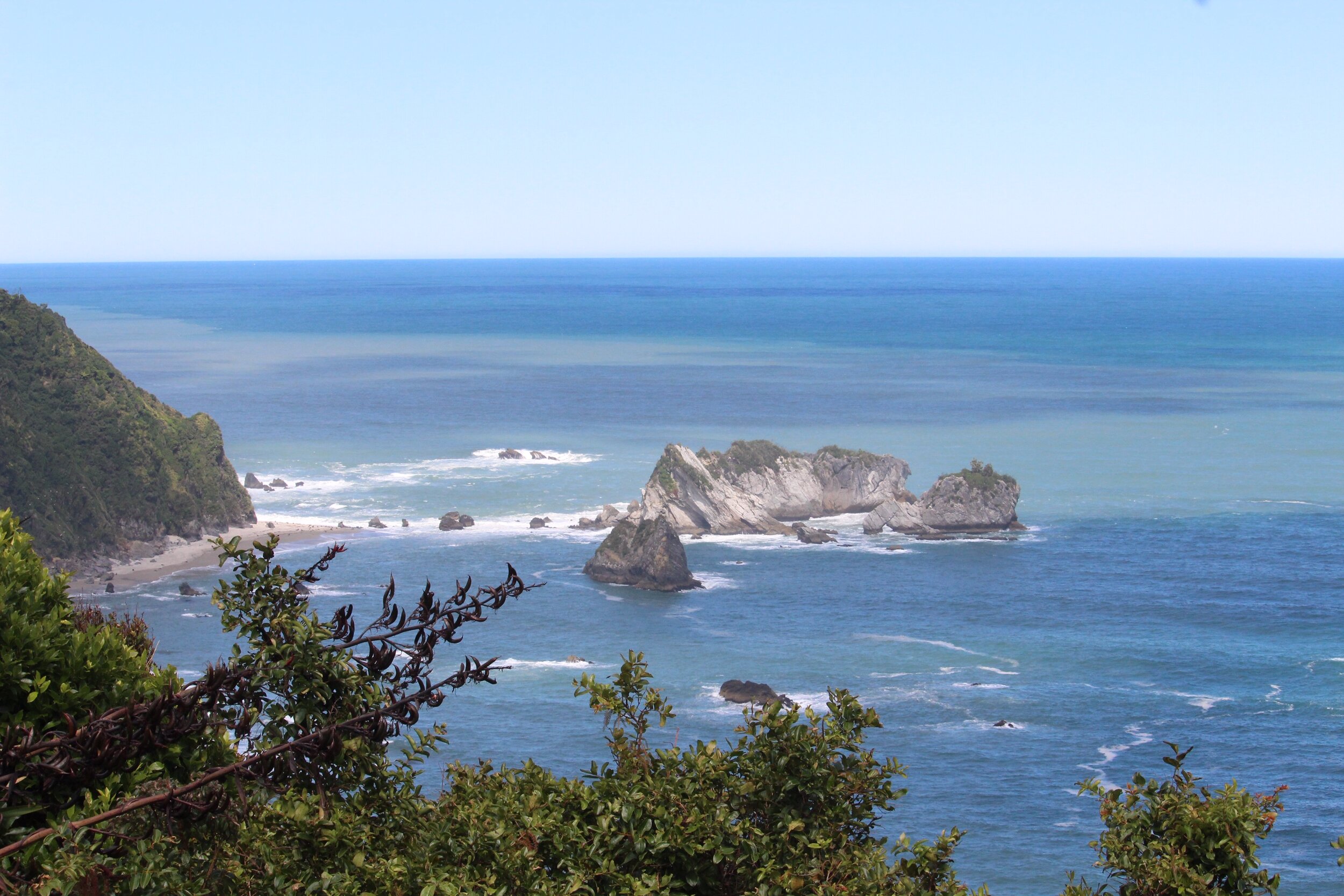
Pancake Rocks
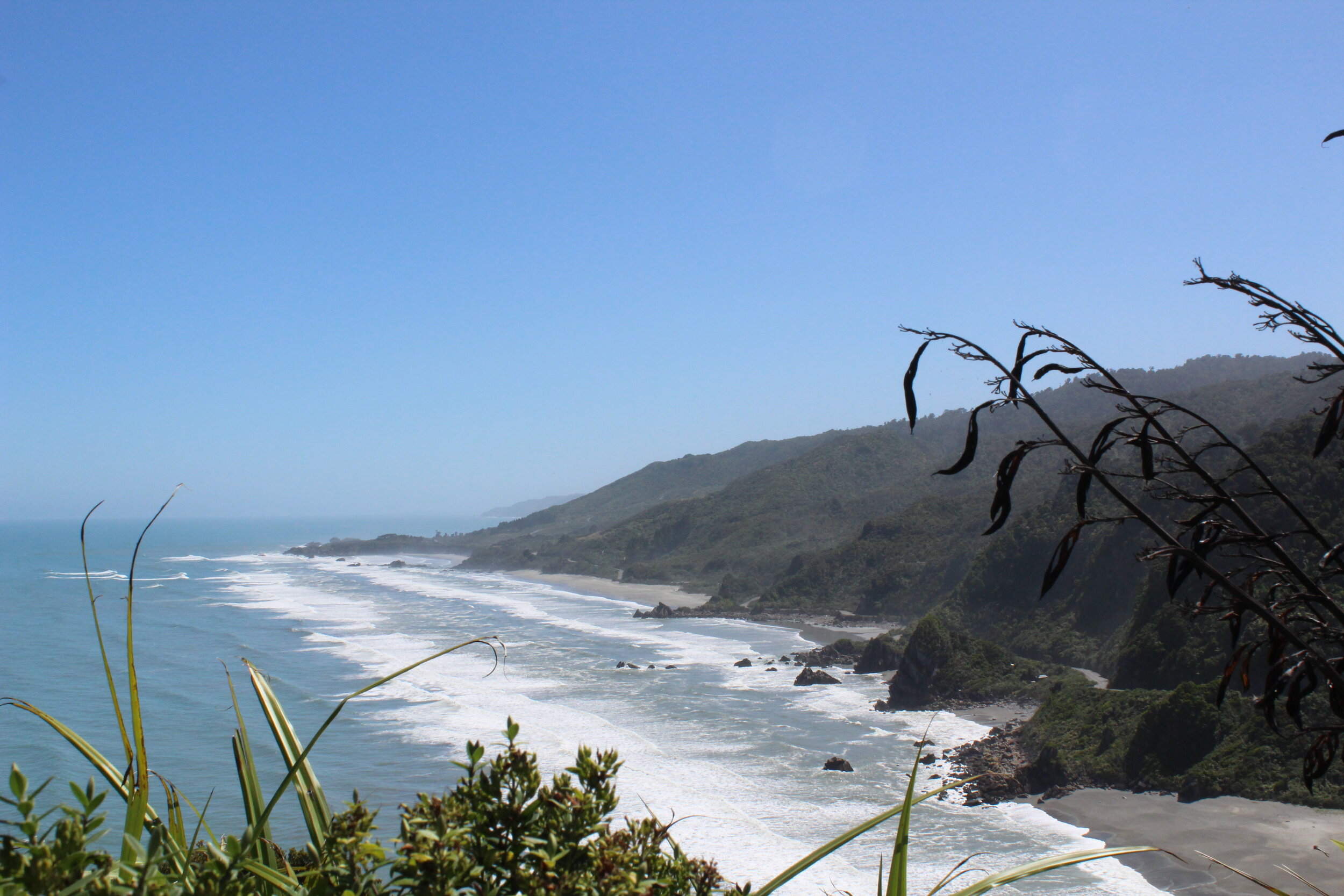
À 56km de Westport se trouvent les Pancake Rocks, nommées ainsi à cause de leur forme. La roche calcaire du littoral est érodée par les vagues et la corrosion de l’eau leur font prendre des aspects uniformes.
Fifty six kilometers from Westport stand the Pancake Rocks, named after their shape. The limestone rock of the coastline is eroded by the waves and the corrosion of the water gives them their uniform appearance.
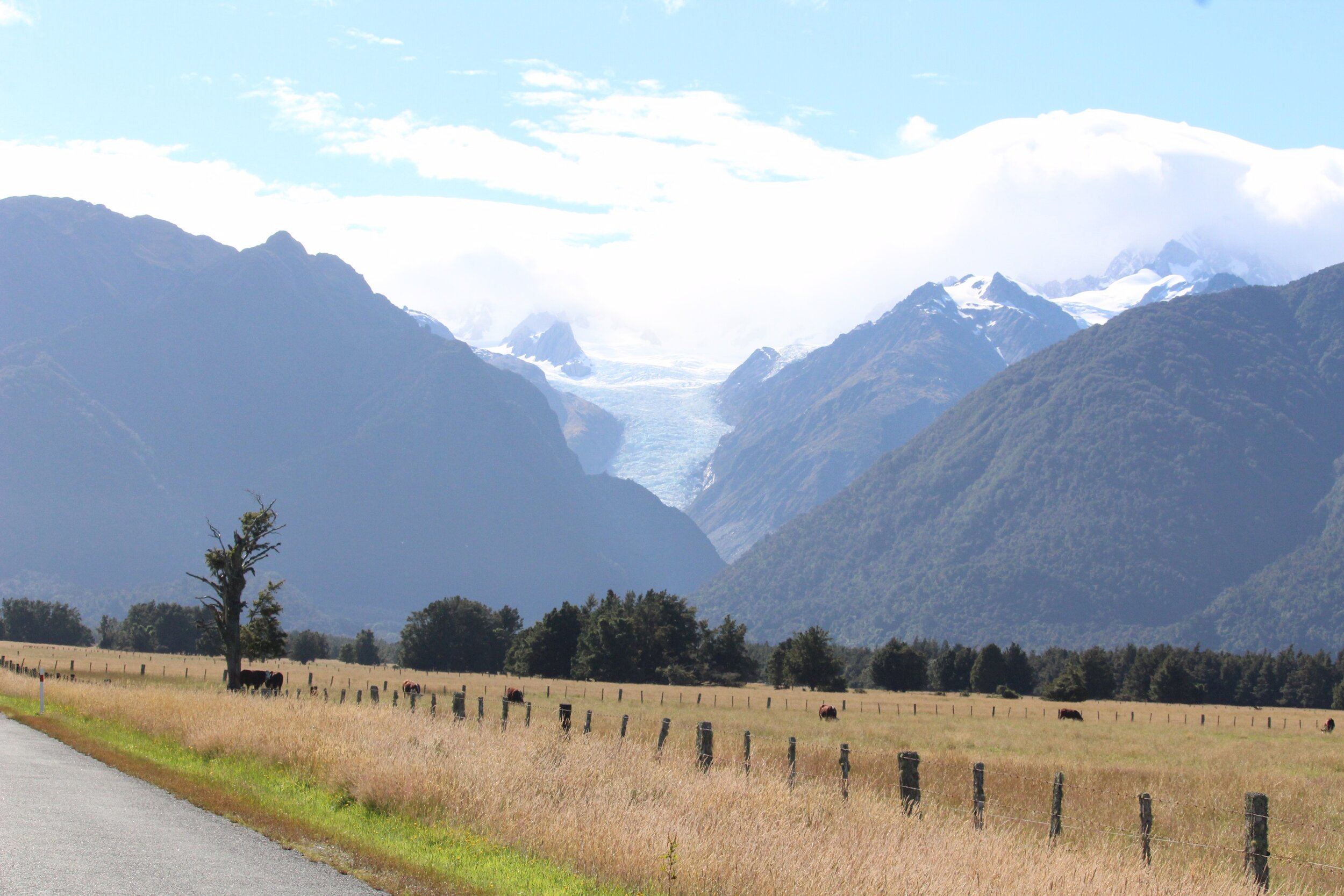
Whataroa
Whataroa est un cours d’eau qui fait partie de la côte ouest, à 144 km des Pancake Rocks. Sa source se situe dans les alpes du sud et elle s’écoule vers le nord avant d’atteindre la mer de Tasman.
À voir : les glaciers Franz Josef et Fox!
Whataroa is a stream on the west coast, 144 km from the Pancake Rocks. Its source is located in the Southern Alps, and it flows north before reaching the Tasman Sea.
To see: the Franz Josef and Fox glaciers!
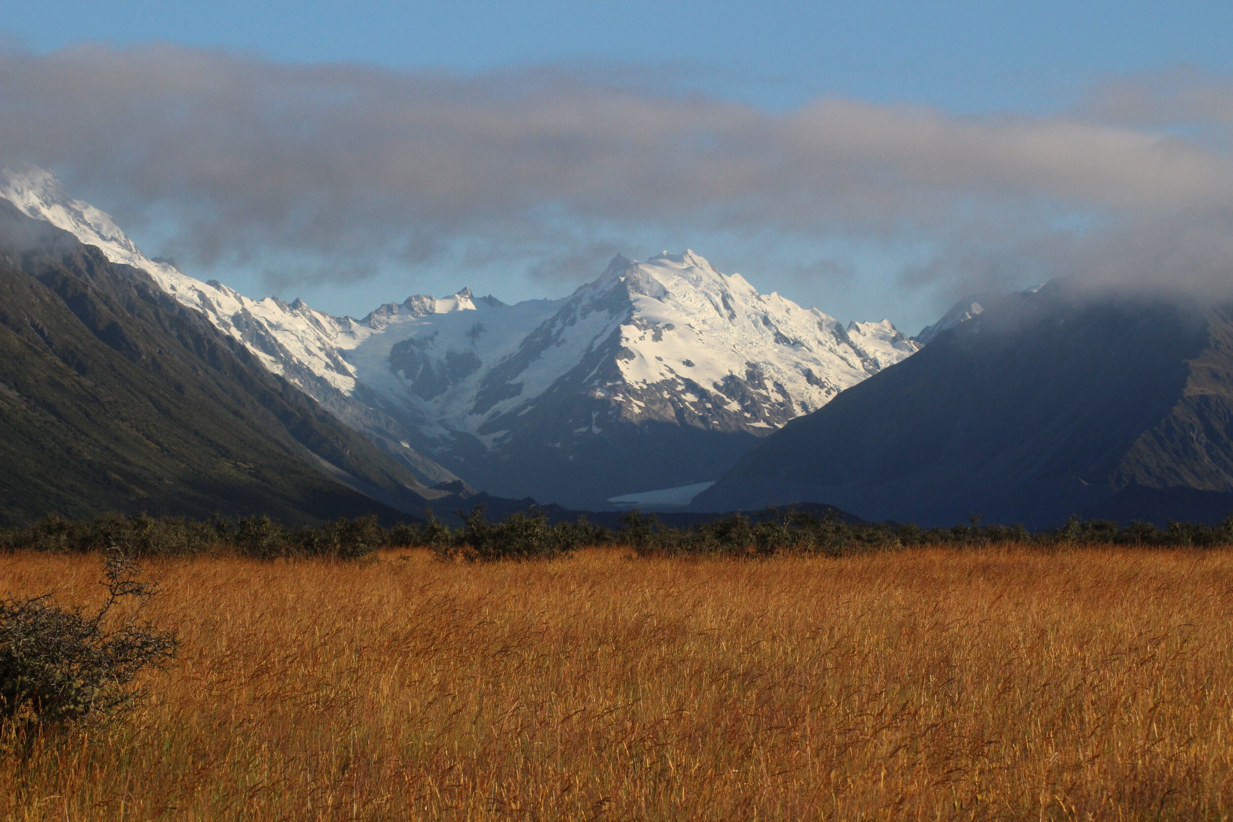
Le mont Cook
Mount Cook
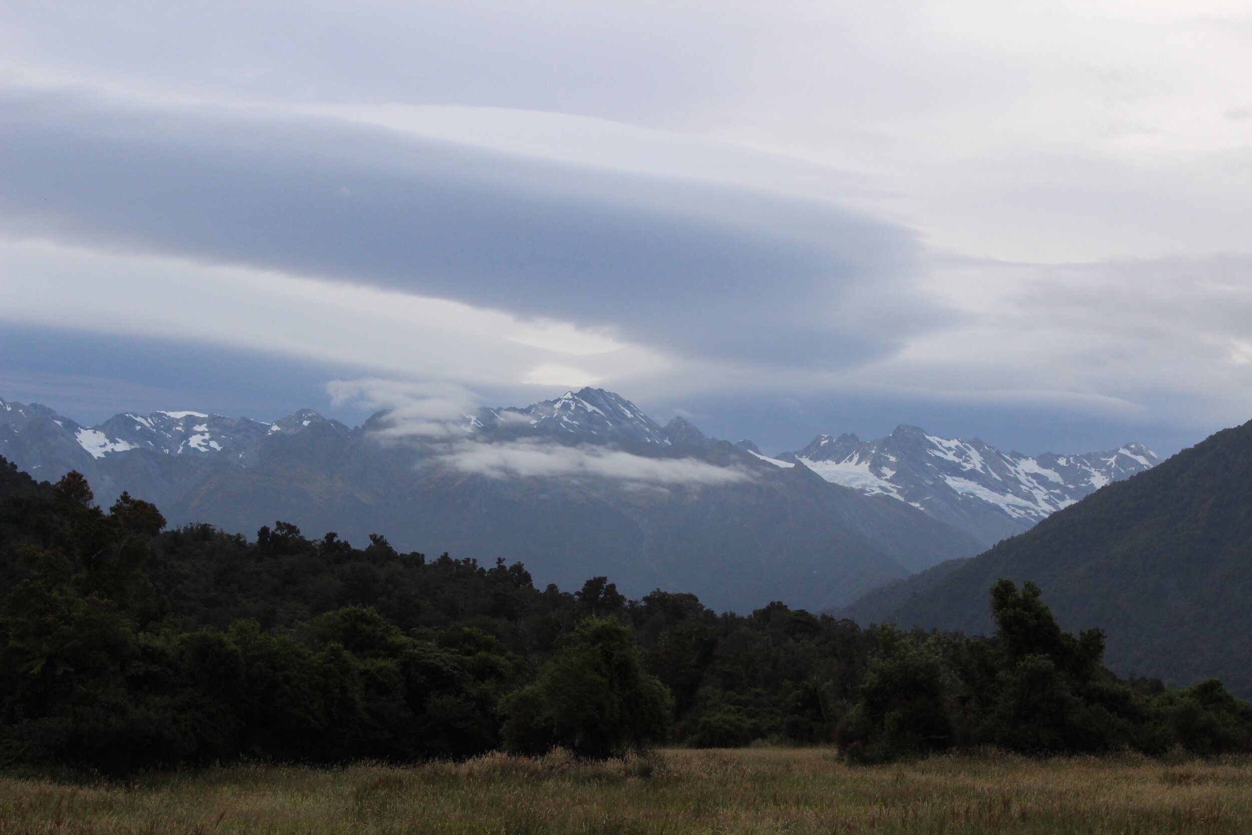
Pour ma prochaine destination, je devais malheureusement faire un très long détour de 520 km, de Whataroa au Mont Cook, en passant par Wanaka.
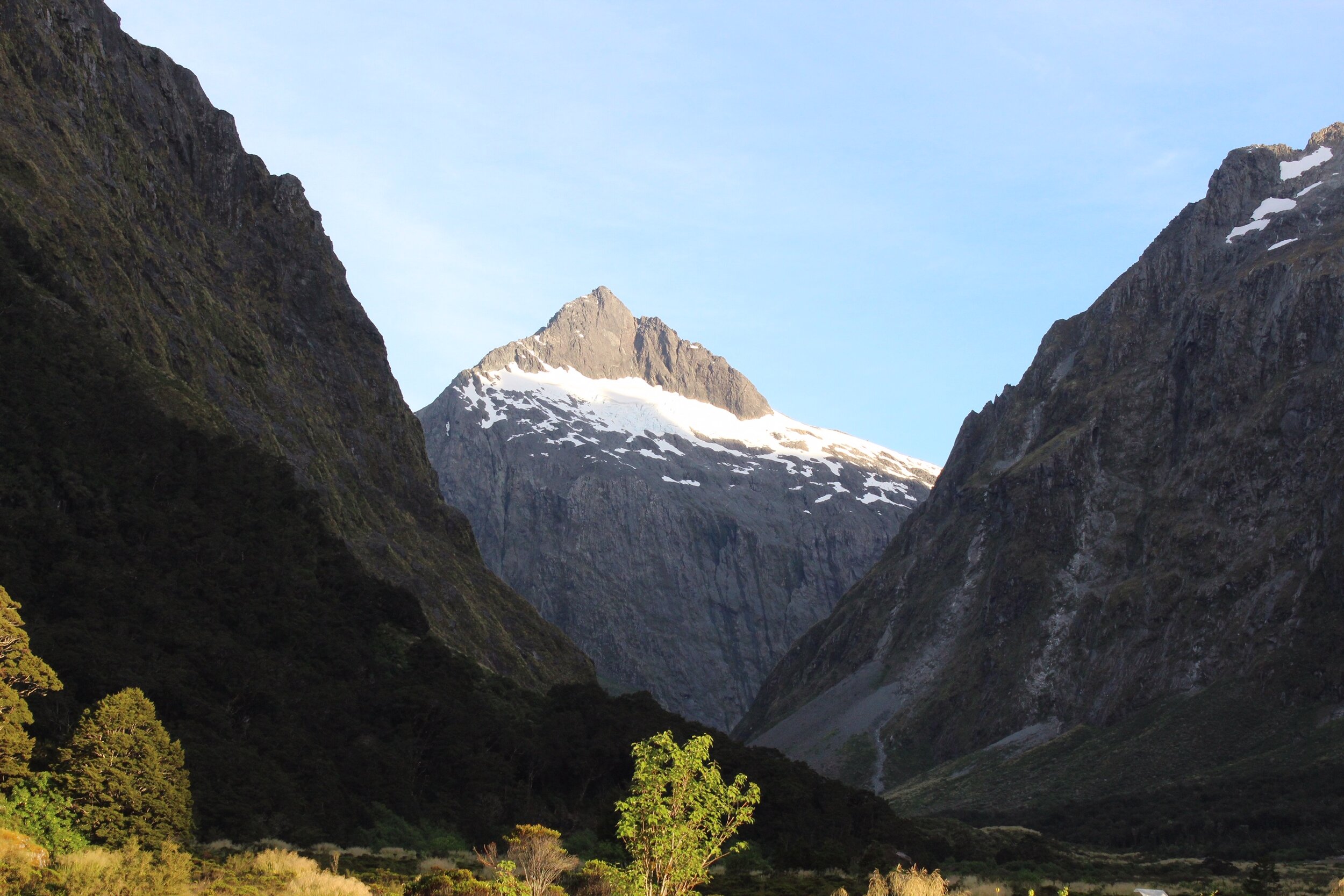
Le merveilleux Mont Cook, à 3 724 m d’altitude au-dessus du glacier Tasman, est nommé en hommage à l’explorateur James Cook. J’ai eu la chance de me trouver un beau petit parc où dormir. J’avais une vue du sud-est du Mont Cook, wow!
For my next destination, I unfortunately had to make a very long detour of 520 km, from Whataroa to Mount Cook, via Wanaka.
The magnificent Mount Cook, at an altitude of 3,724 m above the Tasman Glacier, is named in honor of the explorer James Cook. I was lucky to find myself a beautiful little park to sleep in. I had a view of southeast of Mount Cook. Wow!
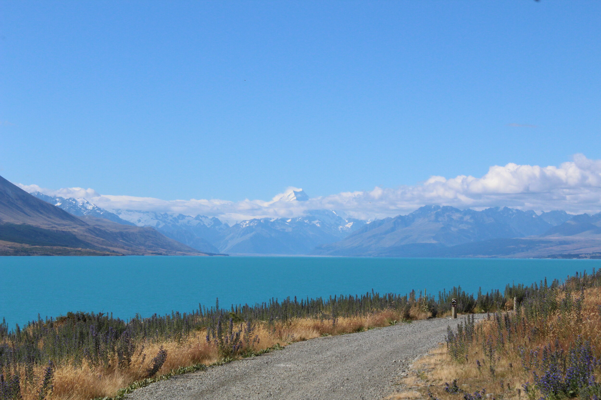
Wanaka
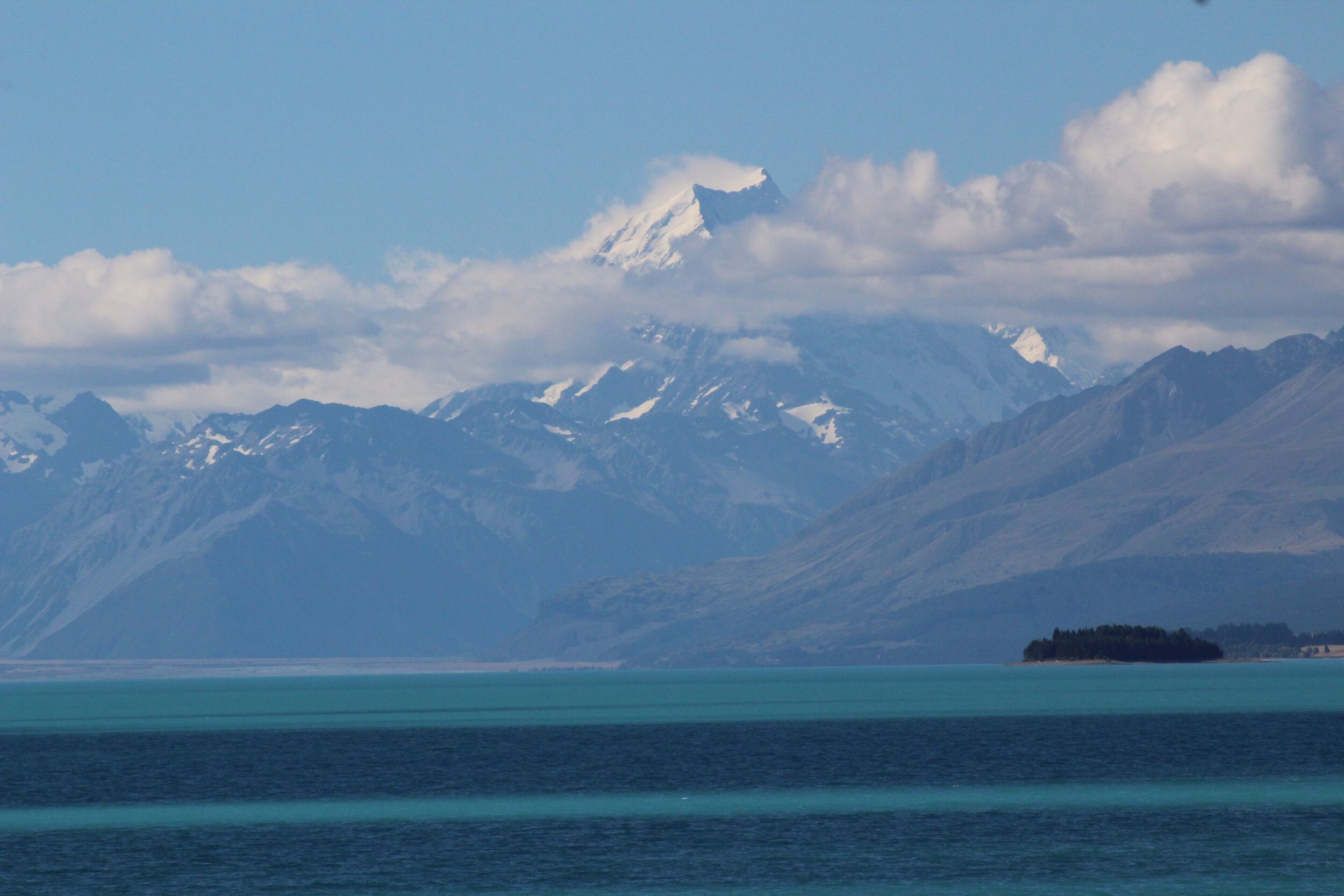
Je suis retourné à Wanaka, très belle ville située près du lac Wanaka, après ma visite magique au Mont Cook. Ce fut un arrêt épicerie et essence.
J’étais en suite en route vers l’une de mes dernières destinations, Milford Sound. J’ai croisé le lac Wakatipu, qui est le plus long lac du pays avec ses 80 km. Il est situé en bordure des alpes du sud. Il est possible d’y faire des randonnées pédestres. J’ai ensuite croisé le lac Te Anau, où je me suis arrêté pour la nuit.
After my magical visit to Mount Cook, I returned to Wanaka, a beautiful city near Lake Wanaka. It was mostly a grocery and gas stop.
I was then en route to one of my last destinations, Milford Sound. I crossed Lake Wakatipu, which at 80 km is the longest lake in the country. It’s located on the edge of the Southern Alps, where you can go hiking. I then stopped for the night at Lake Te Anau.
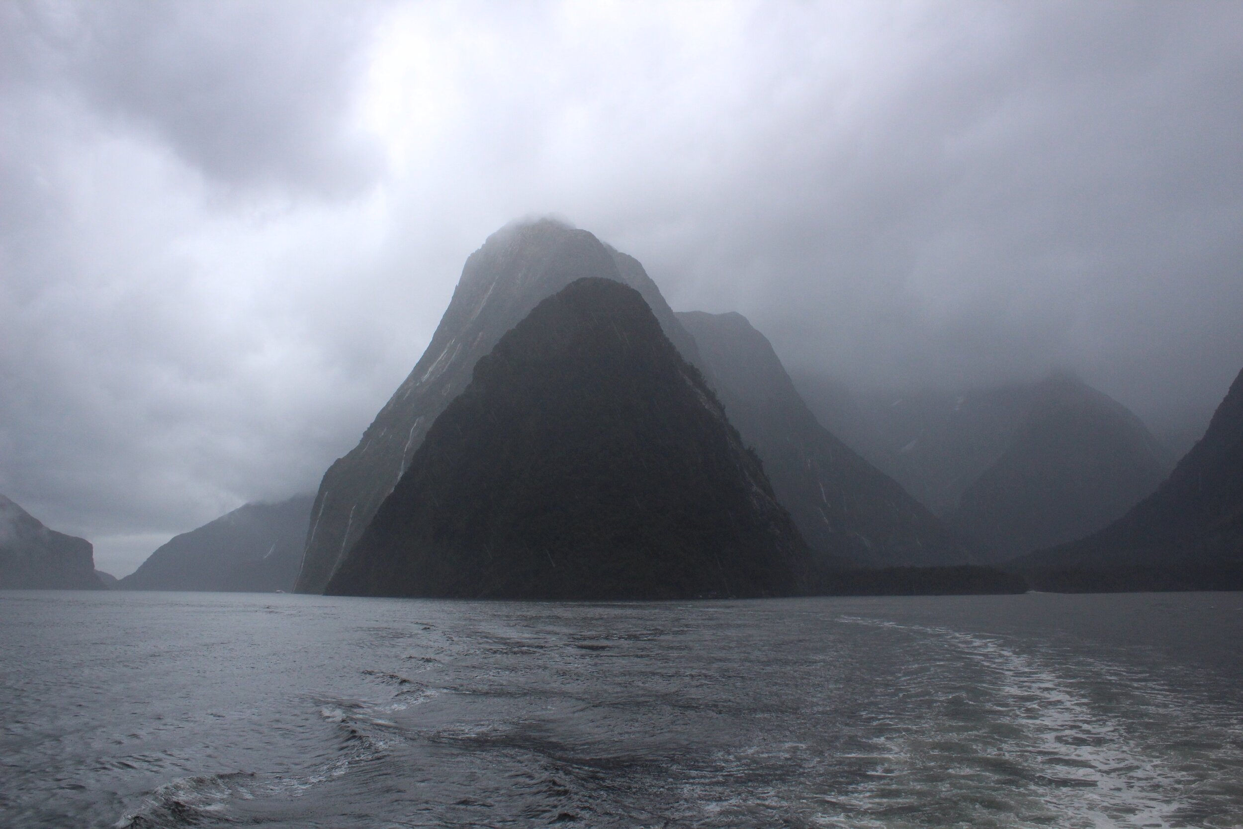
Milford Sound
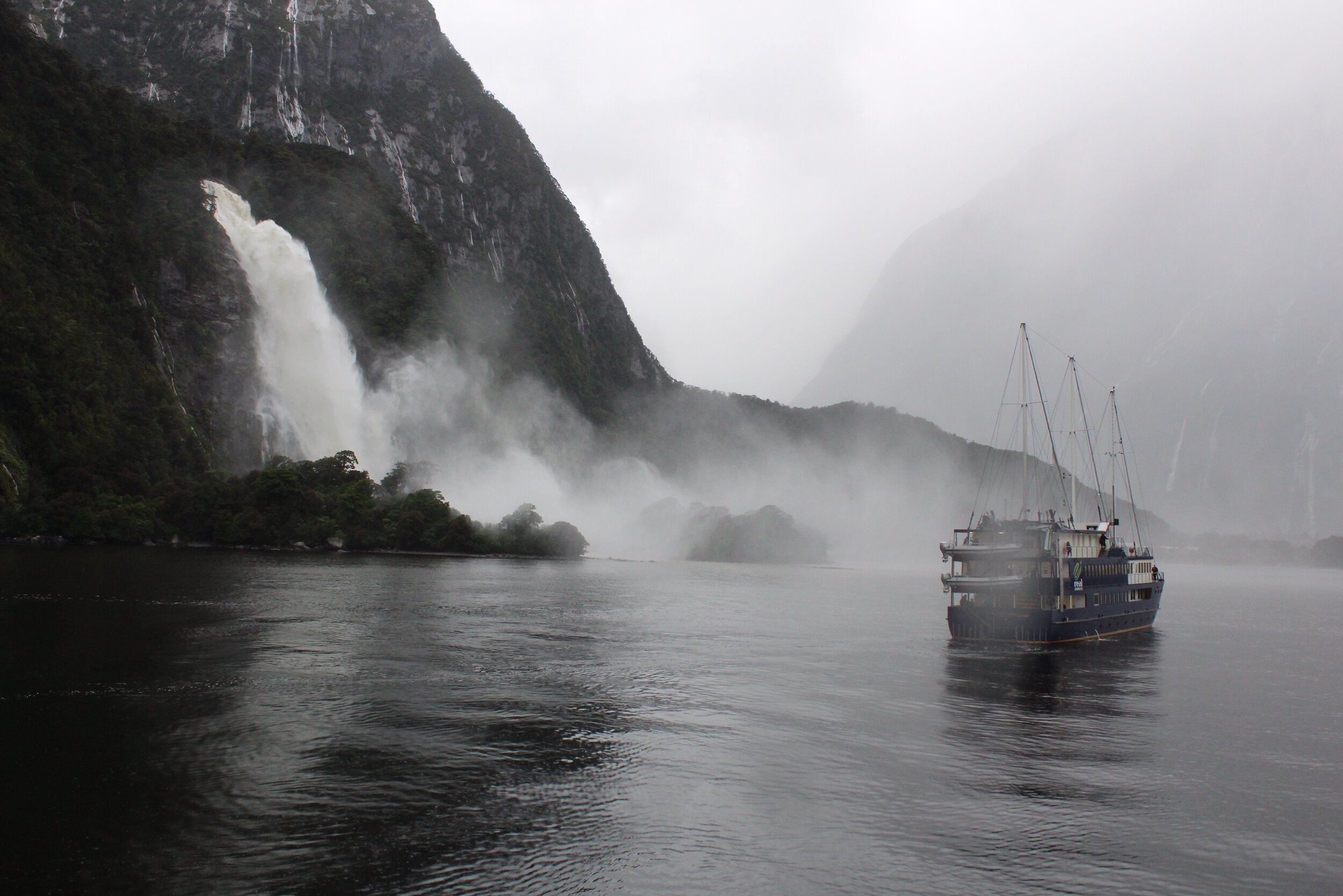
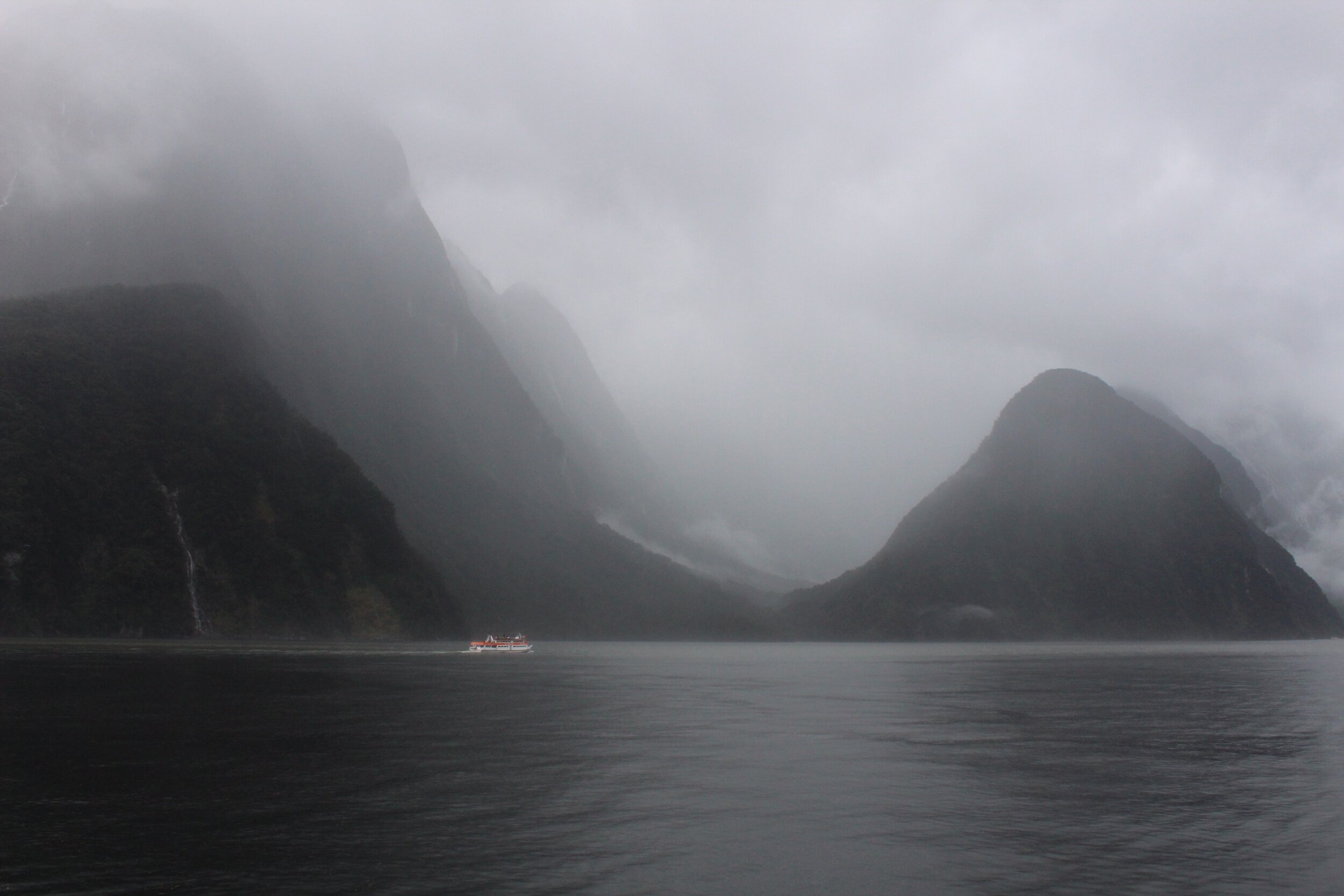
Enfin arrivé à Milford Sound, après avoir parcouru 342 km! La ville est située au sud-ouest de l’île, toujours du côté de la mer de Tasman. C’est un magnifique endroit à voir!
Les parois des montagnes ont des dénivelés de plus de 1 200 m et une altitude de 1 692 m. La profondeur du fjord dépasse les 400 m.
Les maoris habitaient la région vers l’an 1000. L’explorateur James Cook est le premier européen à avoir découvert la région de Milford Sound.
Lors de mon passage, j’ai fait une croisière et c’était le déluge! Il a eu une impressionnante tempête de pluie, à voir dans les photos!
I was finally arrived at Milford Sound, after covering 342 km! The city is located in the southwest of the island, still on the Tasman Sea side. It’s a wonderful place to see!
The mountain walls have elevation differences of more than 1,200 m, and an altitude of 1,692 m. The depth of the fjord exceeds 400 m. Maori people lived in the area around year 1000. Explorer James Cook was the first European to discover the Milford Sound area. During my visit, I went on a cruise and there was a deluge! It was an impressive rainstorm, as you can see in the photos!
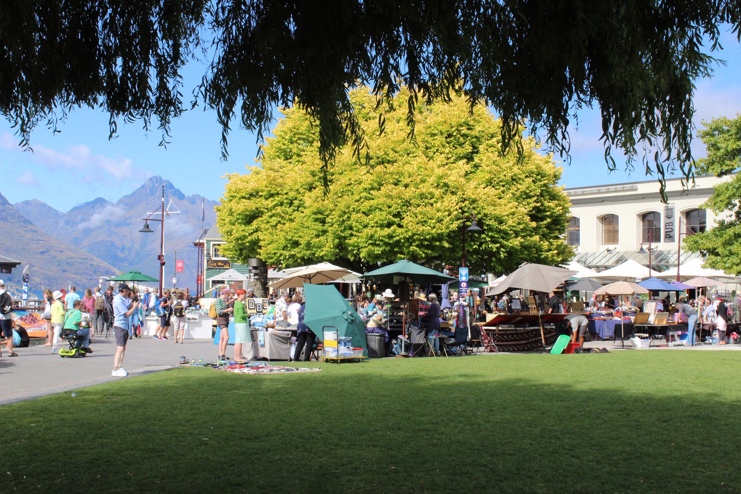
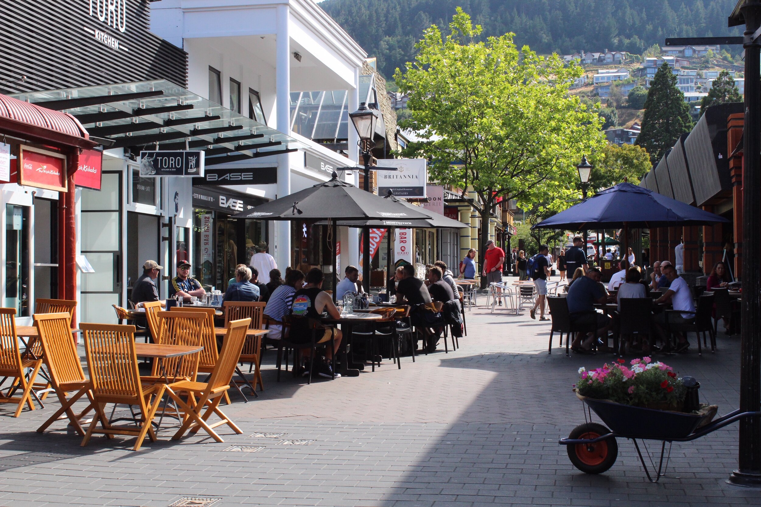
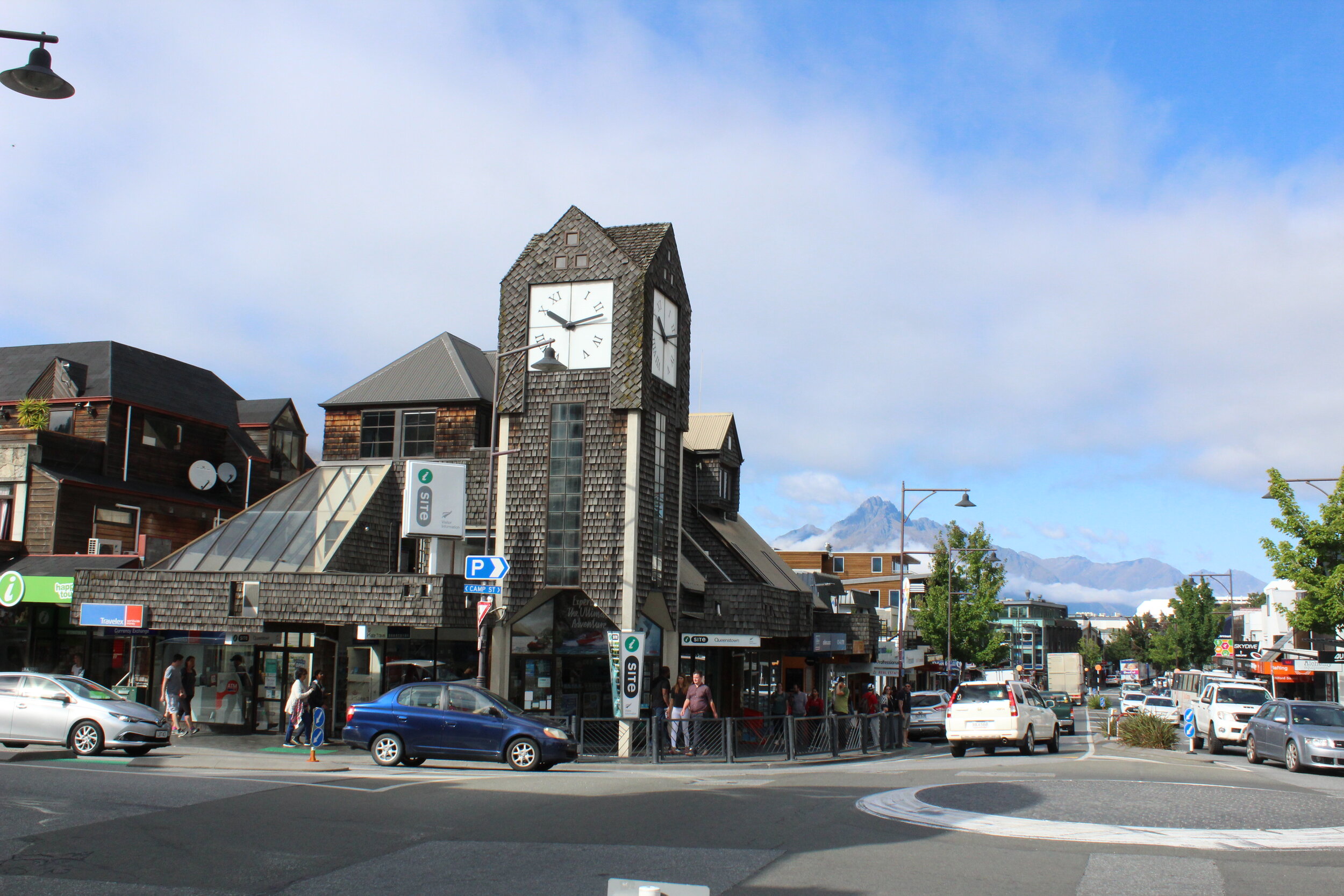
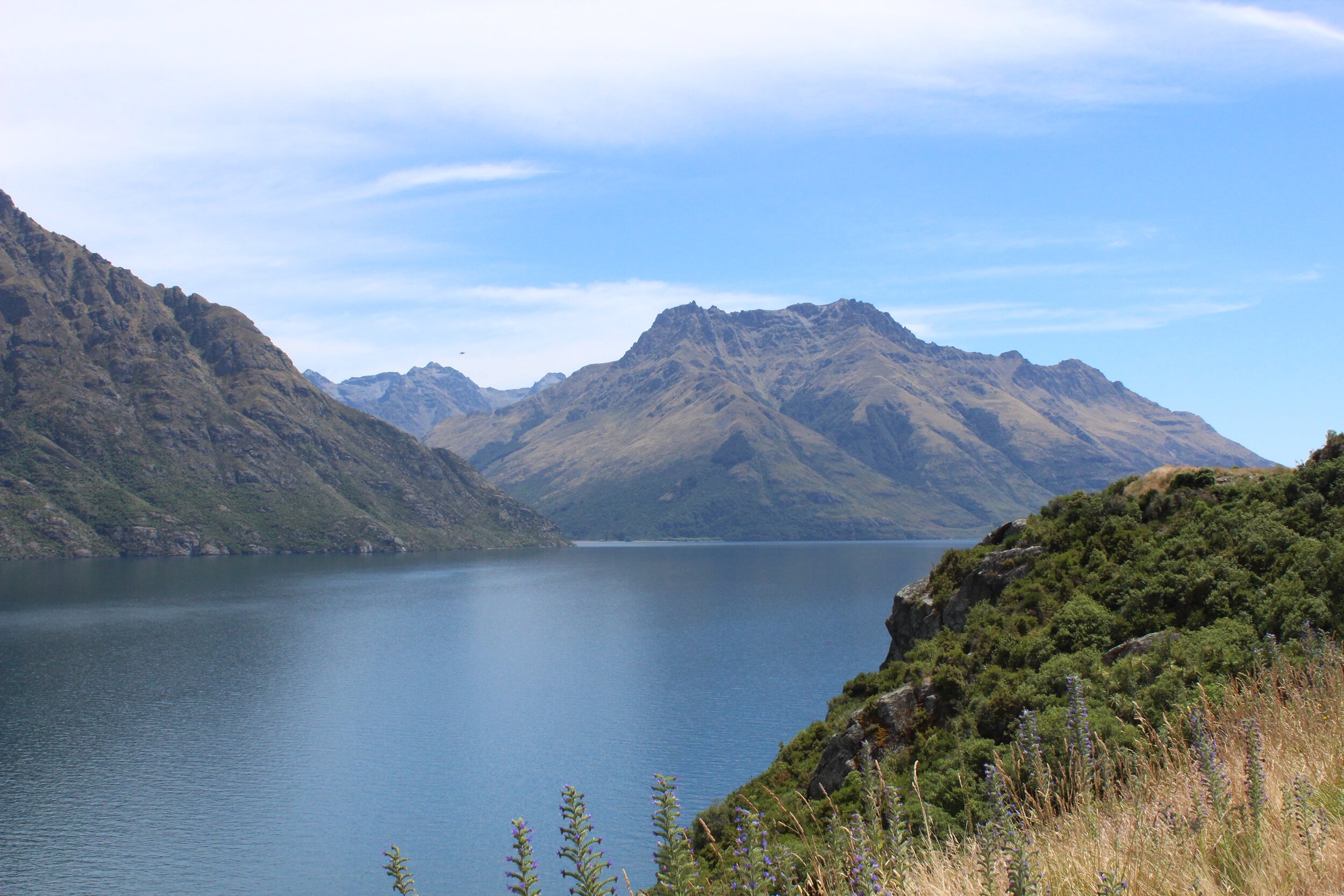
Queenstown
Après avoir dormi près de Milford Sound, j’étais en route vers Queenstown, ma dernière destination. La ville est construite autour du lac Wakatipu et est reconnue pour ses activités de sports extrêmes. J’avais réservé à l’auberge de jeunesse YHA Queenstown Lakefront Backpckers pour mes derniers jours en Nouvelle-Zélande.
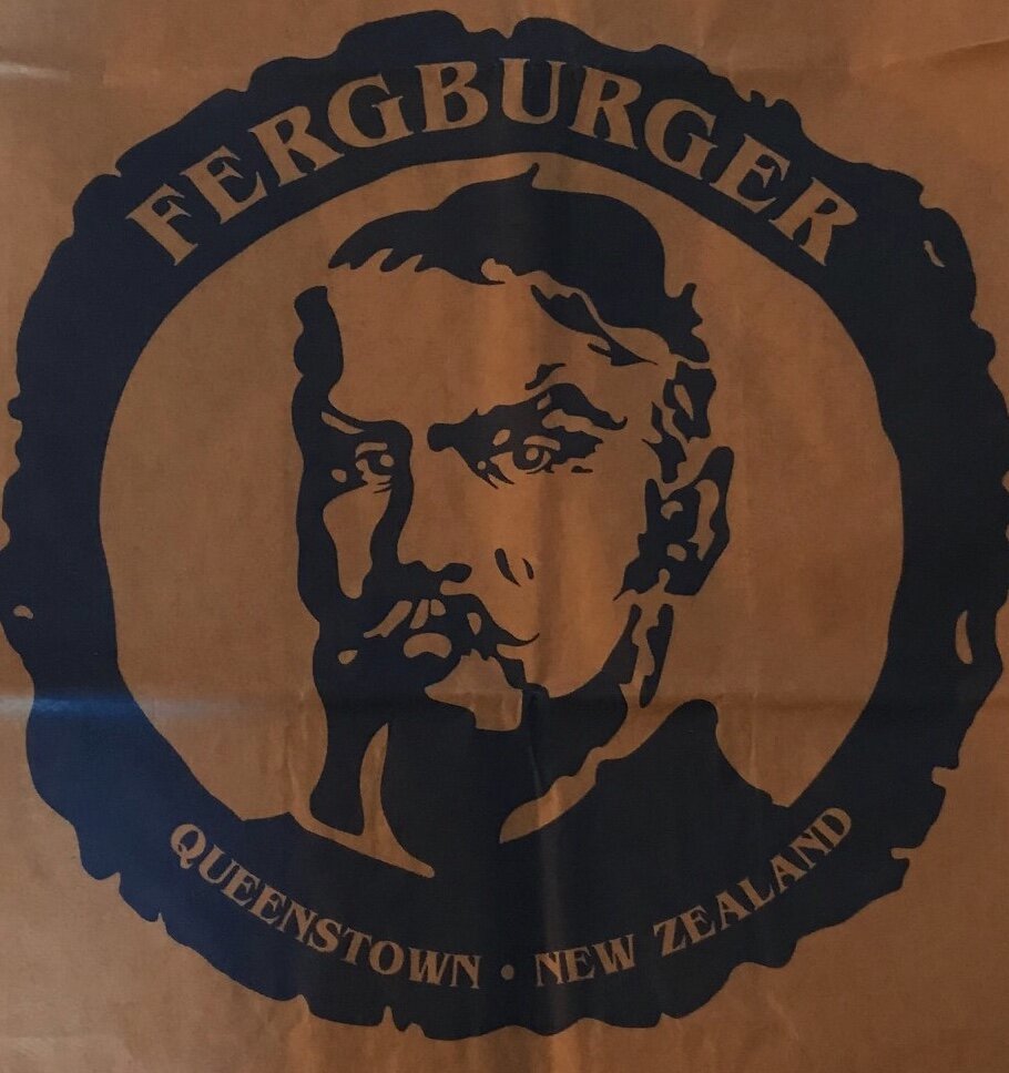
À faire : se balader au centre-ville, prendre ça cool sur la plage et aller manger un des meilleurs hamburgers au monde chez Fengburger! (42, rue Shotover)
After sleeping near Milford Sound, I was on my way to Queenstown, the last destination. The city is built around Lake Wakatipu and is known for its extreme sports activities. I booked the YHA Queenstown Lakefront Backpckers hostel for my last days in New Zealand.
To do : stroll downtown, take it cool on the beach and eat one of the best burgers in the world at Fengburger! (42 Shotover Street)